IMAGES TAKEN NEAR TO
Roper Lane, BRADFORD, BD13 2NR
Introduction
This page details the photographs taken nearby to Roper Lane, BD13 2NR by members of the Geograph project.
The Geograph project started in 2005 with the aim of publishing, organising and preserving representative images for every square kilometre of Great Britain, Ireland and the Isle of Man.

There are currently over 7.5m images from over14,400 individuals and you can help contribute to the project by visiting https://www.geograph.org.uk
Image Map (Loading...)


Getting Data...Please wait
Leaflet Map data © OpenStreetMap
Images are licensed for reuse under creativecommons.org/licenses/by-sa/2.0
Notes
- Clicking on the map will re-center to the selected point.
- The higher the marker number, the further away the image location is from the centre of the postcode.
Image Listing (23 Images Found)
Images are licensed for reuse under creativecommons.org/licenses/by-sa/2.0
Image
Details
Distance
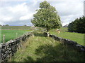
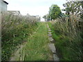
1
Stiles on branches of Queensbury FP21
Image: © Humphrey Bolton
Taken: 13 Sep 2018
0.07 miles
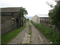
3
Queensbury FP20 at Lower Warmfield Farm
Image: © Humphrey Bolton
Taken: 13 Sep 2018
0.09 miles
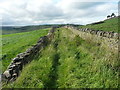
5
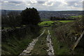
Track heading West from Warmleigh Farm
Image: © Chris Heaton
Taken: 21 Mar 2017
0.10 miles
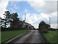
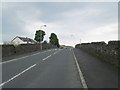
7
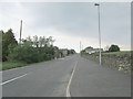
Roper Lane - viewed from Cross Lane
Image: © Betty Longbottom
Taken: 19 Jun 2013
0.13 miles
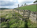
8
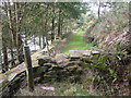
Stile on Queensbury FP23
Not a proper stile, but just a jumble of stones at one end of a low wall across the path.
Image: © Humphrey Bolton
Taken: 13 Sep 2018
0.13 miles