IMAGES TAKEN NEAR TO
Prospect Gardens, BRADFORD, BD13 1FG
Introduction
This page details the photographs taken nearby to Prospect Gardens, BD13 1FG by members of the Geograph project.
The Geograph project started in 2005 with the aim of publishing, organising and preserving representative images for every square kilometre of Great Britain, Ireland and the Isle of Man.

There are currently over 7.5m images from over14,400 individuals and you can help contribute to the project by visiting https://www.geograph.org.uk
Image Map
Images are licensed for reuse under creativecommons.org/licenses/by-sa/2.0
Notes
- Clicking on the map will re-center to the selected point.
- The higher the marker number, the further away the image location is from the centre of the postcode.
Image Listing (180 Images Found)
Images are licensed for reuse under creativecommons.org/licenses/by-sa/2.0
Image
Details
Distance
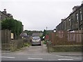
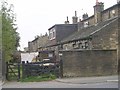
4
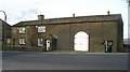
Scarlet Heights Farm - Scarlet Heights
Image: © Betty Longbottom
Taken: 3 Nov 2007
0.04 miles
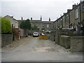
5
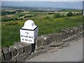
Milestone at Scarlet Heights, Queensbury
This is now beautifully restored, along with many others on the Bradford to Halifax road. This is what it used to look like Image, then it was painted white all over: Image, and now the lettering has been picked out in black.
Image: © Humphrey Bolton
Taken: 24 Jun 2010
0.05 miles
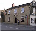
9
Wellington Street - Brunswick Street
Image: © Betty Longbottom
Taken: 19 Sep 2009
0.05 miles