IMAGES TAKEN NEAR TO
Lyon Street, BRADFORD, BD13 1AY
Introduction
This page details the photographs taken nearby to Lyon Street, BD13 1AY by members of the Geograph project.
The Geograph project started in 2005 with the aim of publishing, organising and preserving representative images for every square kilometre of Great Britain, Ireland and the Isle of Man.

There are currently over 7.5m images from over14,400 individuals and you can help contribute to the project by visiting https://www.geograph.org.uk
Image Map
Images are licensed for reuse under creativecommons.org/licenses/by-sa/2.0
Notes
- Clicking on the map will re-center to the selected point.
- The higher the marker number, the further away the image location is from the centre of the postcode.
Image Listing (191 Images Found)
Images are licensed for reuse under creativecommons.org/licenses/by-sa/2.0
Image
Details
Distance
7
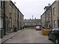
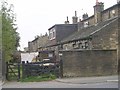
Wellington Street - Brunswick Street
Image: © Betty Longbottom
Taken: 19 Sep 2009
0.04 miles
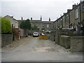
8
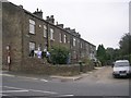
Scarlet Heights Farm - Scarlet Heights
Image: © Betty Longbottom
Taken: 3 Nov 2007
0.04 miles
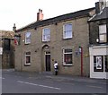
9
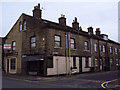
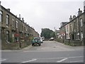
Street corner, Bradford
This is the corner of Brunswick Street and #38 Sand Beds in Queensbury, Bradford.
Image: © Slbs
Taken: Unknown
0.04 miles
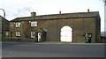
10
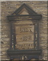
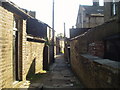
Union is Strength
Plaque above the Handyman Shop on Sandbeds, Queensbury. http://www.geograph.org.uk/photo/5178396
Image: © Ian S
Taken: 15 Oct 2016
0.04 miles