IMAGES TAKEN NEAR TO
Common Road, BRADFORD, BD12 0TL
Introduction
This page details the photographs taken nearby to Common Road, BD12 0TL by members of the Geograph project.
The Geograph project started in 2005 with the aim of publishing, organising and preserving representative images for every square kilometre of Great Britain, Ireland and the Isle of Man.

There are currently over 7.5m images from over14,400 individuals and you can help contribute to the project by visiting https://www.geograph.org.uk
Image Map
Images are licensed for reuse under creativecommons.org/licenses/by-sa/2.0
Notes
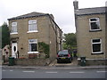
- Clicking on the map will re-center to the selected point.
- The higher the marker number, the further away the image location is from the centre of the postcode.
Image Listing (115 Images Found)
Images are licensed for reuse under creativecommons.org/licenses/by-sa/2.0
Image
Details
Distance
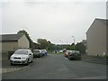
2
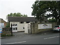
Rainbow House Day Nursery - Common Road
Image: © Betty Longbottom
Taken: 26 Aug 2011
0.04 miles
4
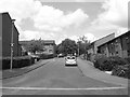
Edward Turner Close - Lower School Street
Image: © Betty Longbottom
Taken: 14 Jun 2009
0.06 miles
6
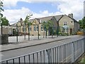
Hill Top Church of England Primary School - Common Road
Image: © Betty Longbottom
Taken: 14 Jun 2009
0.07 miles
8
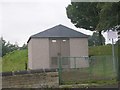
Electricity Substation No 859 - Park Road
Image: © Betty Longbottom
Taken: 26 Aug 2011
0.07 miles
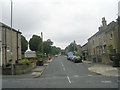
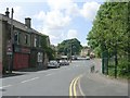
9
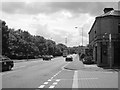
Huddersfield Road - viewed from Common Road
Image: © Betty Longbottom
Taken: 14 Jun 2009
0.08 miles