IMAGES TAKEN NEAR TO
Fieldhead Lane, BRADFORD, BD11 1JL
Introduction
This page details the photographs taken nearby to Fieldhead Lane, BD11 1JL by members of the Geograph project.
The Geograph project started in 2005 with the aim of publishing, organising and preserving representative images for every square kilometre of Great Britain, Ireland and the Isle of Man.

There are currently over 7.5m images from over14,400 individuals and you can help contribute to the project by visiting https://www.geograph.org.uk
Image Map
Images are licensed for reuse under creativecommons.org/licenses/by-sa/2.0
Notes
- Clicking on the map will re-center to the selected point.
- The higher the marker number, the further away the image location is from the centre of the postcode.
Image Listing (35 Images Found)
Images are licensed for reuse under creativecommons.org/licenses/by-sa/2.0
Image
Details
Distance
1
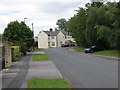
Field Head Lane at Drighlington
Looking south-eastward. This section of Field Head Lane became a dead-end with the opening of the Drighlington By-pass (A650). Formerly it was the direct link between Drighlington and Birstall.
Image: © Peter Wood
Taken: 14 Jul 2017
0.02 miles
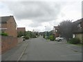
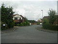
2
Field Head Lane - viewed from Paddock Drive
Image: © Betty Longbottom
Taken: 23 Aug 2011
0.05 miles
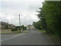
4
Old course of Field Head Lane
The lane used to pass under the Wakefield to Bradford railway line, that closed in 1966. The route of the line is now the Drighlington Bypass, which the lane now meets at a right angle on a new alignment.
Image: © Stephen Craven
Taken: 14 Jun 2020
0.06 miles
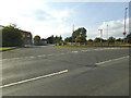
6
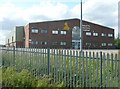
Warehouse off Field Head Lane, Birstall
Near to Junction 27 on the M62.
Image: © Humphrey Bolton
Taken: 18 Jun 2009
0.10 miles
7
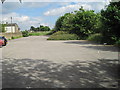
Drighlington & Adwalton railway station (site), Yorkshire
Opened in 1856 by the Great Northern Railway on the line from Wakefield Westgate to Bradford and Halifax, this station closed to passengers in 1962.
View south east towards Gildersome and Wakefield, also Howden Clough and Dewsbury. This position would probably have been between the two platforms. Just out of view, the A650 now joins the former trackbed from the right. The site is now partly a pub car park.
Image: © Nigel Thompson
Taken: 14 Jun 2014
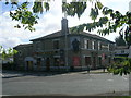
0.10 miles
8
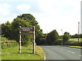
Welcome to Batley
The sign is on Field Head Lane, a short way beyond the Leeds / Kirklees borough boundary which is at the top of the lane.
Image: © Stephen Craven
Taken: 14 Jun 2020
0.10 miles
10
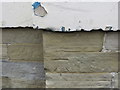
Ordnance Survey Cut Mark
This mark can be found on the roadside wall of The Railway PH in Birstall Lane, Drighlington. The benchmark height is recorded as being 188.9 metres above sea level.
For more detail see : http://www.bench-marks.org.uk/bm59926
Image: © Peter Wood
Taken: 14 Jul 2017
0.14 miles