IMAGES TAKEN NEAR TO
Fir Tree Gardens, BRADFORD, BD10 9BU
Introduction
This page details the photographs taken nearby to Fir Tree Gardens, BD10 9BU by members of the Geograph project.
The Geograph project started in 2005 with the aim of publishing, organising and preserving representative images for every square kilometre of Great Britain, Ireland and the Isle of Man.

There are currently over 7.5m images from over14,400 individuals and you can help contribute to the project by visiting https://www.geograph.org.uk
Image Map
Images are licensed for reuse under creativecommons.org/licenses/by-sa/2.0
Notes
- Clicking on the map will re-center to the selected point.
- The higher the marker number, the further away the image location is from the centre of the postcode.
Image Listing (115 Images Found)
Images are licensed for reuse under creativecommons.org/licenses/by-sa/2.0
Image
Details
Distance
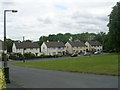
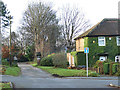
3
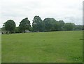
Playing Fields - off Brunswick Road
Image: © Betty Longbottom
Taken: 15 Jun 2011
0.05 miles
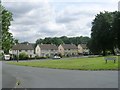
5
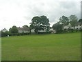
Playing Fields - off Brunswick Road
Image: © Betty Longbottom
Taken: 15 Jun 2011
0.05 miles
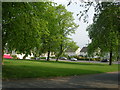
6
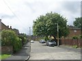
Cherry Tree Avenue - Harrogate Road
Image: © Betty Longbottom
Taken: 24 Jul 2009
0.07 miles
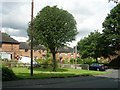
7
The Drive, off Harrogate Road, Greengates
Prominently marked as a private road, it principally serves Hill Side Villas, but also a set of allotments.
Image: © Stephen Craven
Taken: 30 Nov 2019
0.09 miles
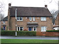
8
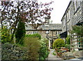
Haigh Hall, Greengates
This dates from 1710. Next to the rear entrance of Greengates Park.
Image: © Linden Milner
Taken: 19 Apr 2007
0.09 miles