IMAGES TAKEN NEAR TO
Stonegate Road, BRADFORD, BD10 8BU
Introduction
This page details the photographs taken nearby to Stonegate Road, BD10 8BU by members of the Geograph project.
The Geograph project started in 2005 with the aim of publishing, organising and preserving representative images for every square kilometre of Great Britain, Ireland and the Isle of Man.

There are currently over 7.5m images from over14,400 individuals and you can help contribute to the project by visiting https://www.geograph.org.uk
Image Map
Images are licensed for reuse under creativecommons.org/licenses/by-sa/2.0
Notes
- Clicking on the map will re-center to the selected point.
- The higher the marker number, the further away the image location is from the centre of the postcode.
Image Listing (102 Images Found)
Images are licensed for reuse under creativecommons.org/licenses/by-sa/2.0
Image
Details
Distance
1
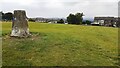
Eccleshill recreation ground
At the left hand side of the image is an Ordnance Survey triangulation pillar (see https://trigpointing.uk/trig/3017 ) with a flush bracket benchmark set in its south face Image
Image: © Roger Templeman
Taken: 28 Aug 2024
0.05 miles
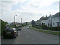
4
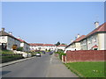
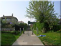
Path - Stonegate Road -Sandholme Drive
Image: © Betty Longbottom
Taken: 22 Apr 2011
0.08 miles
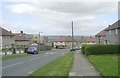
8
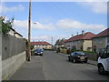
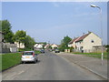
Sandfield Road - viewed from Greystone Crescent
Image: © Betty Longbottom
Taken: 22 Apr 2011
0.09 miles
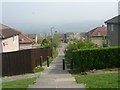
10
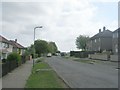
Path - Sandholme Drive-Stonegate Road
Image: © Betty Longbottom
Taken: 22 Apr 2011
0.10 miles