IMAGES TAKEN NEAR TO
Jowett Park Crescent, BRADFORD, BD10 0SX
Introduction
This page details the photographs taken nearby to Jowett Park Crescent, BD10 0SX by members of the Geograph project.
The Geograph project started in 2005 with the aim of publishing, organising and preserving representative images for every square kilometre of Great Britain, Ireland and the Isle of Man.

There are currently over 7.5m images from over14,400 individuals and you can help contribute to the project by visiting https://www.geograph.org.uk
Image Map
Images are licensed for reuse under creativecommons.org/licenses/by-sa/2.0
Notes
- Clicking on the map will re-center to the selected point.
- The higher the marker number, the further away the image location is from the centre of the postcode.
Image Listing (102 Images Found)
Images are licensed for reuse under creativecommons.org/licenses/by-sa/2.0
Image
Details
Distance
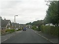
1
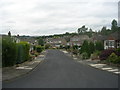
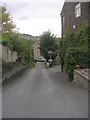
Jowett Park Crescent - Trenam Park Drive
Image: © Betty Longbottom
Taken: 24 Aug 2011
0.04 miles
2
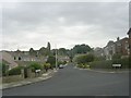
Jowett Park Crescent - Ballantyne Road
Image: © Betty Longbottom
Taken: 24 Aug 2011
0.06 miles
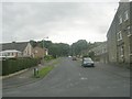
3
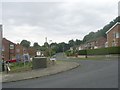
Trenam Park Drive - Ballantyne Road
Image: © Betty Longbottom
Taken: 24 Aug 2011
0.06 miles
4
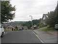
Brackendale Avenue - Windhill Old Road
Image: © Betty Longbottom
Taken: 24 Aug 2011
0.06 miles
5
Brackendale Avenue - Windhill Old Road
Image: © Betty Longbottom
Taken: 24 Aug 2011
0.08 miles
6
Bridge BRB SHI-30 - top of Ballantyne Road
Image: © Betty Longbottom
Taken: 24 Aug 2011
0.08 miles
7
Ballantyne Road - Windhill Old Road
Image: © Betty Longbottom
Taken: 24 Aug 2011
0.08 miles
8
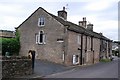
Idle Workhouse
Former Workhouse, Windhill Old Road.
Image: © Andrew Riley
Taken: 2 Aug 2008
0.09 miles
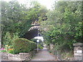
10
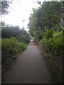
Footpath under Bridge BRB SHI-30 - Ballantyne Road
Image: © Betty Longbottom
Taken: 24 Aug 2011
0.09 miles