
IMAGES TAKEN NEAR TO
Hallam Road, NELSON, BB9 8DN
Introduction
This page details the photographs taken nearby to Hallam Road, BB9 8DN by members of the Geograph project.
The Geograph project started in 2005 with the aim of publishing, organising and preserving representative images for every square kilometre of Great Britain, Ireland and the Isle of Man.

There are currently over 7.5m images from over14,400 individuals and you can help contribute to the project by visiting https://www.geograph.org.uk
Image Map
Images are licensed for reuse under creativecommons.org/licenses/by-sa/2.0
Notes
- Clicking on the map will re-center to the selected point.
- The higher the marker number, the further away the image location is from the centre of the postcode.
Image Listing (14 Images Found)
Images are licensed for reuse under creativecommons.org/licenses/by-sa/2.0
Image
Details
Distance
1
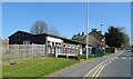
Williams Hall, Nelson
Community Centre on Barkerhouse Road.
Image: © JThomas
Taken: 19 Apr 2019
0.13 miles
4
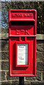
Close up, Elizabeth II postbox on Barkerhouse Road, Nelson
Postbox No. BB9 231.
See Image] for wider view.
Image: © JThomas
Taken: 19 Apr 2019
0.15 miles
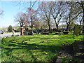
6
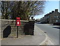
Elizabeth II postbox on Barkerhouse Road, Nelson
Postbox No. BB9 231.
See Image] for close up.
Image: © JThomas
Taken: 19 Apr 2019
0.16 miles
7
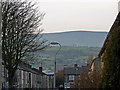
Town and country
Brentwood Road Nelson is on the outskirts of this industrial town of mostly terraced houses.
In the distance is Pendle Hill, it is the birth place of the famous 'Pendle Witches' and is the hill that the area as a whole takes its name from.
Image: © Meg Metcalfe
Taken: 20 Nov 2006
0.17 miles
8
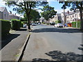
Marsden Hall Road, Nelson
Looking south-westward.
Image: © Peter Wood
Taken: 8 Aug 2018
0.17 miles
9
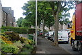
Marsden Hall Road, Nelson
This road has council properties, and the Council's housing repair men appear to be having a blitz on repairs at the moment.
Image: © Bill Boaden
Taken: 16 Jun 2011
0.18 miles
10
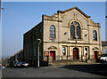
Baptist Church, Nelson, Lancashire
Although on the map supplied with the Geograph website, this church appears to be to the north of the 380 grid line, accurate maps show it to be fractionally to the south of this line, so it is in square 8637, not 8638. To judge from the outside, it is an active and robust church and will not 'go under' as so many nonconformist (and Anglican) churches have, in this area.
Image: © Dr Neil Clifton
Taken: 19 Mar 2009
0.21 miles