IMAGES TAKEN NEAR TO
Milton Street, NELSON, BB9 7TH
Introduction
This page details the photographs taken nearby to Milton Street, BB9 7TH by members of the Geograph project.
The Geograph project started in 2005 with the aim of publishing, organising and preserving representative images for every square kilometre of Great Britain, Ireland and the Isle of Man.

There are currently over 7.5m images from over14,400 individuals and you can help contribute to the project by visiting https://www.geograph.org.uk
Image Map
Images are licensed for reuse under creativecommons.org/licenses/by-sa/2.0
Notes
- Clicking on the map will re-center to the selected point.
- The higher the marker number, the further away the image location is from the centre of the postcode.
Image Listing (145 Images Found)
Images are licensed for reuse under creativecommons.org/licenses/by-sa/2.0
Image
Details
Distance
2
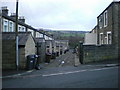
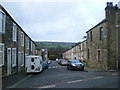
Back street
Between Kendal Street and Beddington Street
Image: © Alexander P Kapp
Taken: 23 Nov 2009
0.03 miles
4
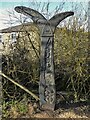
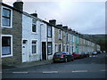
National Cycle Network Milestone
On route No.68 by the Leeds & Liverpool Canal
Image: © Kevin Waterhouse
Taken: 6 Feb 2023
0.06 miles
5
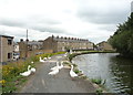
Blocked path
Geese standing guard beside the Leeds and Liverpool Canal.
Image: © JThomas
Taken: 2 Aug 2018
0.06 miles
6
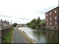
Leeds and Liverpool Canal north of Carr Road Bridge
Image: © JThomas
Taken: 2 Aug 2018
0.07 miles
7
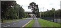
M65 Bridge over the B6249 Carr Road, Nelson
Image: © Robert Wade
Taken: 23 Aug 2011
0.07 miles
8
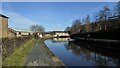
Leeds & Liverpool Canal
On the towpath ahead is a National Cycle Network Milestone for this route No.68
Image: © Kevin Waterhouse
Taken: 6 Feb 2023
0.07 miles
9
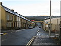
Carr Road, Nelson, Lancashire
Carr Road is part of the B6249 and runs westward out of Nelson, connecting it with the Pendleside villages such as Fence and Higham. The terrace houses here are fully occupied and well-maintained, contrasting with the situation in the Whitefield area just to the south. Here, the street which crosses at right angles is Norfolk Street, while further down is the bridge carrying the M65, with a Warburton's bread van (a common sight in Lancashire) travelling south.
Image: © Dr Neil Clifton
Taken: 9 Dec 2008
0.07 miles