Carr Road, Nelson, Lancashire
Introduction
The photograph on this page of Carr Road, Nelson, Lancashire by Dr Neil Clifton as part of the Geograph project.
The Geograph project started in 2005 with the aim of publishing, organising and preserving representative images for every square kilometre of Great Britain, Ireland and the Isle of Man.

There are currently over 7.5m images from over 14,400 individuals and you can help contribute to the project by visiting https://www.geograph.org.uk
Carr Road, Nelson, Lancashire
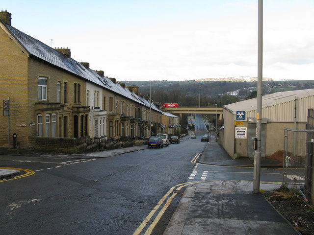
Image: © Dr Neil Clifton Taken: 9 Dec 2008
Carr Road is part of the B6249 and runs westward out of Nelson, connecting it with the Pendleside villages such as Fence and Higham. The terrace houses here are fully occupied and well-maintained, contrasting with the situation in the Whitefield area just to the south. Here, the street which crosses at right angles is Norfolk Street, while further down is the bridge carrying the M65, with a Warburton's bread van (a common sight in Lancashire) travelling south.
Images are licensed for reuse under creativecommons.org/licenses/by-sa/2.0
Image Location
Latitude
53.838319
Longitude
-2.220007