
IMAGES TAKEN NEAR TO
Gisburn Road, NELSON, BB9 6NQ
Introduction
This page details the photographs taken nearby to Gisburn Road, BB9 6NQ by members of the Geograph project.
The Geograph project started in 2005 with the aim of publishing, organising and preserving representative images for every square kilometre of Great Britain, Ireland and the Isle of Man.

There are currently over 7.5m images from over14,400 individuals and you can help contribute to the project by visiting https://www.geograph.org.uk
Image Map
Images are licensed for reuse under creativecommons.org/licenses/by-sa/2.0
Notes
- Clicking on the map will re-center to the selected point.
- The higher the marker number, the further away the image location is from the centre of the postcode.
Image Listing (8 Images Found)
Images are licensed for reuse under creativecommons.org/licenses/by-sa/2.0
Image
Details
Distance
1
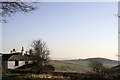
Gisburn Road
View of Blacko Tower from Greystone Lodge
Image: © Kevin Rushton
Taken: 19 Feb 2008
0.02 miles
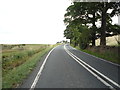
3
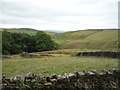
Grazing and woodland near Greystone
View from Gisburn Road (A682).
Image: © JThomas
Taken: 2 Aug 2018
0.08 miles
4
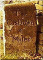
Old Milestone by the A682, Greystone, Middop Parish
Carved stone post by the A682, in parish of MIDDOP (RIBBLE VALLEY District), Greystone, between Moorcock Inn and Greystone Inn (flats), by the road, on North side of road.
Inscription reads:- : To / Burnley / 8 / Miles : : To / Gisburn / 4 / Miles :
Carved benchmark on upper front (defaced).
Milestone Society National ID: YW_GNBL04.
Image: © JH
Taken: 1 Apr 2004
0.10 miles
5
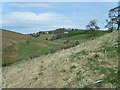
Admergill Water from The Pendle Way
The valley demonstrates interlocking spurs just to the west of the A682. With the slopes of Weets Hill in the distance that rises to 397 metres, we are only 6km north of the urban areas of Colne and Nelson. In the foreground is a recently planted deciduous forest. The new forest will fill the whole of the eastern slope from the stream to the A682 at this point.
Image: © R Greenhalgh
Taken: 28 Apr 2010
0.15 miles
6
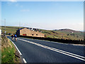
The A682 near the 'Moorcock'
Looking south. The house on the right is a barn conversion. On the skyline is seen Stansfield Tower, Blacko, which is right on the Yorkshire-Lancashire boundary.
Image: © Dr Neil Clifton
Taken: 21 Apr 2006
0.22 miles
7
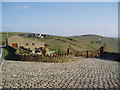
Barn conversion
This attractive barn conversion is on the west side of the A682 just opposite the Moorcock Inn. The white farm behind is Admergill Pasture, while Stansfield Tower, right on the Lancashire-Yorkshire boundary, can be seen on the skyline.
Image: © Dr Neil Clifton
Taken: 21 Apr 2006
0.23 miles
8
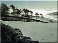
Greystone Moor in winter
A stand of trees by the A682 Gisburn Road. Looking SSE towards Blacko. In the distance, Stansfield Tower stands above the cloud in the Pendle valley.
Image: © Ian Taylor
Taken: Unknown
0.24 miles