Barn conversion
Introduction
The photograph on this page of Barn conversion by Dr Neil Clifton as part of the Geograph project.
The Geograph project started in 2005 with the aim of publishing, organising and preserving representative images for every square kilometre of Great Britain, Ireland and the Isle of Man.

There are currently over 7.5m images from over 14,400 individuals and you can help contribute to the project by visiting https://www.geograph.org.uk
Barn conversion
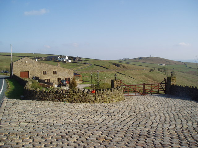
Image: © Dr Neil Clifton Taken: 21 Apr 2006
This attractive barn conversion is on the west side of the A682 just opposite the Moorcock Inn. The white farm behind is Admergill Pasture, while Stansfield Tower, right on the Lancashire-Yorkshire boundary, can be seen on the skyline.
Images are licensed for reuse under creativecommons.org/licenses/by-sa/2.0
Image Location


Leaflet Map data © OpenStreetMap
Latitude
53.88569
Longitude
-2.217517