
IMAGES TAKEN NEAR TO
Mitton Avenue, NELSON, BB9 6BD
Introduction
This page details the photographs taken nearby to Mitton Avenue, BB9 6BD by members of the Geograph project.
The Geograph project started in 2005 with the aim of publishing, organising and preserving representative images for every square kilometre of Great Britain, Ireland and the Isle of Man.

There are currently over 7.5m images from over14,400 individuals and you can help contribute to the project by visiting https://www.geograph.org.uk
Image Map
Images are licensed for reuse under creativecommons.org/licenses/by-sa/2.0
Notes
- Clicking on the map will re-center to the selected point.
- The higher the marker number, the further away the image location is from the centre of the postcode.
Image Listing (8 Images Found)
Images are licensed for reuse under creativecommons.org/licenses/by-sa/2.0
Image
Details
Distance
1
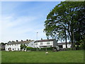
Approaching Barnoldswick Road, Higherford
A short path leads from Red lane towards these dwellings on Barnoldswick Road, Higherford.
Image: © Chris Heaton
Taken: 25 May 2011
0.09 miles
3
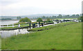
Barrowford Locks
Barrowford Locks on the Leeds and Liverpool Canal, looking south, with Barrowford Reservoir on the left.
Image: © Martin Clark
Taken: Unknown
0.22 miles
4
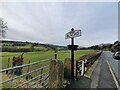
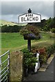
Village Signpost on the A682 Gisburn Road, Blacko
Located between the pavement and a fence on the west side of the A682 Gisburn Road in Blacko parish. 1 plate and cup and bell finial. See also http://www.geograph.org.uk/photo/4264814 and http://www.geograph.org.uk/photo/5904392.
Milestone Society National ID: LA_SD8640V
Image: © D Phillips
Taken: Unknown
0.22 miles
5
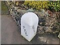
Old Boundary Marker on the A682 Gisburn Road
Parish Boundary Marker against the front wall between Nos. 232 and 230 on the east side of the A682 Gisburn Road. On the boundary between Blacko and Barrowford parishes. Inscribed BLACKO and BARROWFORD diagonally on its adjacent faces.
Milestone Society National ID: LA_GNBU06pb
Image: © D Phillips
Taken: Unknown
0.22 miles
6
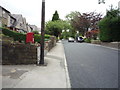
Elizabeth II postbox on Gisburn Road, Higherford
Postbox No. BB9 186.
See Image] for close up.
Image: © JThomas
Taken: 2 Aug 2018
0.23 miles
7
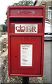
Close up, Elizabeth II postbox on Gisburn Road, Higherford
Postbox No. BB9 186.
See Image] for context.
Image: © JThomas
Taken: 2 Aug 2018
0.23 miles
8
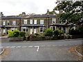
Terraced Housing on Gisburn Road, Higherford
Approaching Gisburn Road from Whittycroft Avenue in Higherford.
Image: © Chris Heaton
Taken: 9 Oct 2012
0.24 miles