
IMAGES TAKEN NEAR TO
Skipton Old Road, COLNE, BB8 7EE
Introduction
This page details the photographs taken nearby to Skipton Old Road, BB8 7EE by members of the Geograph project.
The Geograph project started in 2005 with the aim of publishing, organising and preserving representative images for every square kilometre of Great Britain, Ireland and the Isle of Man.

There are currently over 7.5m images from over14,400 individuals and you can help contribute to the project by visiting https://www.geograph.org.uk
Image Map
Images are licensed for reuse under creativecommons.org/licenses/by-sa/2.0
Notes
- Clicking on the map will re-center to the selected point.
- The higher the marker number, the further away the image location is from the centre of the postcode.
Image Listing (11 Images Found)
Images are licensed for reuse under creativecommons.org/licenses/by-sa/2.0
Image
Details
Distance
1
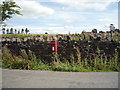
Elizabeth II postbox on Skipton Old Road
Postbox No. BB8 312.
See Image] for close up.
Image: © JThomas
Taken: 11 Aug 2018
0.09 miles
2
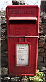
Close up, Elizabeth II postbox on Skipton Old Road
Postbox No. BB8 312.
See Image] for wider view.
Image: © JThomas
Taken: 11 Aug 2018
0.09 miles
3
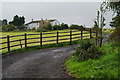
Blue Bell Farm
The local area was also called Blue Bell.
Image: © Bill Boaden
Taken: 29 Aug 2011
0.10 miles
4
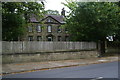
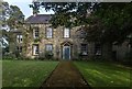
Heyroyd House
A Grade II listed 18th Century house, slightly out of the built-up area on Skipton Old Road.
Image: © Bill Boaden
Taken: 29 Aug 2011
0.13 miles
6
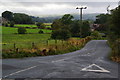
Castle Road, Colne
Seen from its end at Skipton Old Road. The silhouette of Pendle is just visible to the left where the sun is shining through the clouds.
Image: © Bill Boaden
Taken: 29 Aug 2011
0.15 miles
8
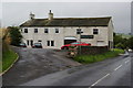
Colne Golf Club
Situated out of the town on Skipton Old Road.
Image: © Bill Boaden
Taken: 29 Aug 2011
0.21 miles
9
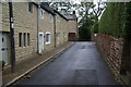
Bent Lane, Colne
Also called Bents on the local signs.
Image: © Bill Boaden
Taken: 29 Aug 2011
0.22 miles
10
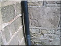
Ordnance Survey Cut Mark
This mark can be found on a house wall at Bents.
For more detail see : http://www.bench-marks.org.uk/bm43623
Image: © Peter Wood
Taken: 23 Jun 2012
0.22 miles