
IMAGES TAKEN NEAR TO
Skipton Old Road, COLNE, BB8 7AE
Introduction
This page details the photographs taken nearby to Skipton Old Road, BB8 7AE by members of the Geograph project.
The Geograph project started in 2005 with the aim of publishing, organising and preserving representative images for every square kilometre of Great Britain, Ireland and the Isle of Man.

There are currently over 7.5m images from over14,400 individuals and you can help contribute to the project by visiting https://www.geograph.org.uk
Image Map
Images are licensed for reuse under creativecommons.org/licenses/by-sa/2.0
Notes
- Clicking on the map will re-center to the selected point.
- The higher the marker number, the further away the image location is from the centre of the postcode.
Image Listing (13 Images Found)
Images are licensed for reuse under creativecommons.org/licenses/by-sa/2.0
Image
Details
Distance
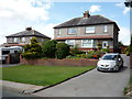
2
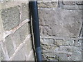
Ordnance Survey Cut Mark
This mark can be found on a house wall at Bents.
For more detail see : http://www.bench-marks.org.uk/bm43623
Image: © Peter Wood
Taken: 23 Jun 2012
0.06 miles
3
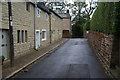
Bent Lane, Colne
Also called Bents on the local signs.
Image: © Bill Boaden
Taken: 29 Aug 2011
0.06 miles
4
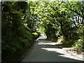
Skipton Old Road towards Colne
Looking south west.
Image: © JThomas
Taken: 11 Aug 2018
0.07 miles
5
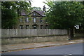
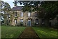
Heyroyd House
A Grade II listed 18th Century house, slightly out of the built-up area on Skipton Old Road.
Image: © Bill Boaden
Taken: 29 Aug 2011
0.17 miles
7
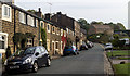
Skipton Old Road
Looking up Skipton Old Road in Colne.
Image: © Peter McDermott
Taken: 10 Oct 2015
0.19 miles
8
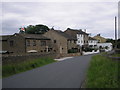
Castle-on-the-Nor, Castle Road, Colne, Lancashire
This attractive group of houses is situated on the northern fringes of Colne.
Image: © Dr Neil Clifton
Taken: 26 Jun 2006
0.21 miles
9
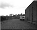
Lower end of the 'Snake Walk'
When the Colne and Trawden Light Railway company decided to build its tramway between the two places named, it found that existing roads would be too steep for trams, so the route as built featured two short stretches of private right of way. The first and lower of these left the public road through the posts at the far end of this section of cobbled street, and rejoined the road a few hundred yards away. Because of the curvaceous nature of the route and the swaying of the cars, this part became known as the 'Snake Walk'.
Image: © Dr Neil Clifton
Taken: 23 Apr 1983
0.21 miles
10
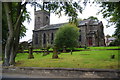
Christ Church, Colne
This is situated right at the eastern extremity of Colne on Keighley Road.
Image: © Bill Boaden
Taken: 29 Aug 2011
0.22 miles