
IMAGES TAKEN NEAR TO
Knowles Brow, CLITHEROE, BB7 9PP
Introduction
This page details the photographs taken nearby to Knowles Brow, BB7 9PP by members of the Geograph project.
The Geograph project started in 2005 with the aim of publishing, organising and preserving representative images for every square kilometre of Great Britain, Ireland and the Isle of Man.

There are currently over 7.5m images from over14,400 individuals and you can help contribute to the project by visiting https://www.geograph.org.uk
Image Map
Images are licensed for reuse under creativecommons.org/licenses/by-sa/2.0
Notes
- Clicking on the map will re-center to the selected point.
- The higher the marker number, the further away the image location is from the centre of the postcode.
Image Listing (27 Images Found)
Images are licensed for reuse under creativecommons.org/licenses/by-sa/2.0
Image
Details
Distance

2
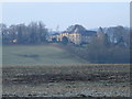
Hodder Place
This building was, I believe, the prep school for the nearby Stonyhurst College.
Image: © Tony Mercer
Taken: 30 Dec 2008
0.05 miles
3
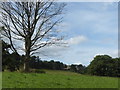
Hodder Place from the bank of the River Hodder
The River Hodder marks the historic county boundary between Lancashire (on this side) and Yorkshire (on the other, east, side). Much of the land in the Hodder Valley further to the north is owned by the Queen as the Duke of Lancaster.
Hodder Place dates from 1780 when it was the home of a cotton mill owner. All traces of the mill, on the river bank below the house, have now vanished. The buildings was greatly extended by the Jesuits in the 19th century when it was used as a Novitiate, and then as a preparatory school until its closure in 1971. It has since been divided into privately owned houses and flats.
Image: © Marathon
Taken: 30 Aug 2018
0.05 miles
4
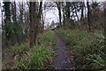
Path up to Hodder Place
The path by the Hodder necessarily has to climb here to negotiate a steep part of the riverbank.
Image: © Bill Boaden
Taken: 28 Nov 2014
0.06 miles
5
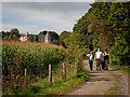
Maize and Hodder Hall
Maize field and Hodder Hall
Image: © Dave Green
Taken: 26 Sep 2010
0.09 miles
6
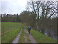
The Ribble Way approaching Hodder Place
The route actually follows the River Hodder for a stretch here.
Image: © Karl and Ali
Taken: 8 Dec 2013
0.11 miles
7
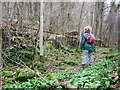
Path near River Hodder
We were looking at a ruined stone wall-like structure next to the river.
Image: © Peter Bond
Taken: 26 Mar 2009
0.12 miles
8
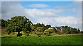
Hodder Hall
Hodder Hall and the south-east edge of Longridge Fell
Image: © Dave Green
Taken: 26 Sep 2010
0.12 miles
9
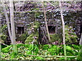
Ruined wall
Strange wall-like ruin on the bank of the River Hodder, below the old prep school. We thought it was part of the cotton mill that was here around 1800. The house above was owned by the mill owner. Newer information has suggested the structure may have been changing rooms used by the school for bathing in the river. They are below the former cricket ground used by the prep school. The sheds first appear (unnamed) on 1895 OS map; they are listed as 'Bathing Sheds' on both 1910 and 1930 revisions.
Image: © Peter Bond
Taken: 26 Mar 2009
0.13 miles
10
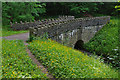
Bridge in Over Hacking Wood
Image: © Ian Taylor
Taken: 20 Jun 2010
0.13 miles