
IMAGES TAKEN NEAR TO
De Lacy Street, CLITHEROE, BB7 2EE
Introduction
This page details the photographs taken nearby to De Lacy Street, BB7 2EE by members of the Geograph project.
The Geograph project started in 2005 with the aim of publishing, organising and preserving representative images for every square kilometre of Great Britain, Ireland and the Isle of Man.

There are currently over 7.5m images from over14,400 individuals and you can help contribute to the project by visiting https://www.geograph.org.uk
Image Map
Images are licensed for reuse under creativecommons.org/licenses/by-sa/2.0
Notes
- Clicking on the map will re-center to the selected point.
- The higher the marker number, the further away the image location is from the centre of the postcode.
Image Listing (511 Images Found)
Images are licensed for reuse under creativecommons.org/licenses/by-sa/2.0
Image
Details
Distance
1
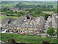
Housing in Clitheroe
Good views of the local architecture are visible from the castle. This block is fronted on Castle View and bounded on its sides by DeLacy Street and Montague Street.
Image: © John Tustin
Taken: 15 Jun 2010
0.04 miles
2
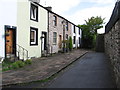
Clitheroe - houses at northern end of Bawdlands
Image: © Dave Bevis
Taken: 15 Aug 2011
0.04 miles
3
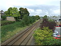
Railway looking north east, Clitheroe
From the bridge on Parson Lane.
Clitheroe Railway Station just visible in the distance.
Image: © JThomas
Taken: 1 Oct 2016
0.06 miles
4
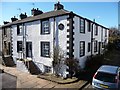
Bawdlands, Clitheroe
Housing from around the 1820s that was the focus of a General Improvement Area in the 1980s. For details of Clitheroe's built history, see www.lancashire.gov.uk/ environment/ documents/ historictowns/ ClitheroeComplete_LowRes.pdf .
Image: © Christine Johnstone
Taken: 12 Mar 2013
0.06 miles
5
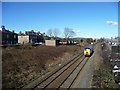
Light engine running south from Clitheroe Station
Direct Rail Services' locomotive 57302 seen from the Parson Lane bridge.
Image: © Christine Johnstone
Taken: 12 Mar 2013
0.06 miles
6
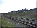
Clitheroe to Blackburn Railway
Looking southwest from Booths car park, with the rear of Castle View backing on to the railway
Image: © Alexander P Kapp
Taken: 15 Apr 2008
0.08 miles
7
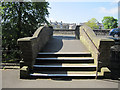
Bridge to Parson Lane from the Wesleyan chapel
This bridge links Parson Lane with the Wesleyan chapel, which was built in 1868. Below the bridge a lane leads to the Stock Well and the castle grounds Image
Image: © John S Turner
Taken: 28 Apr 2011
0.08 miles
8
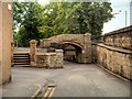
Clitheroe, Footbridge outside Trinity Methodist Church
Image: © David Dixon
Taken: 16 Aug 2015
0.08 miles
9
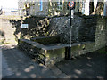
The Stock Well next to the Wesleyan chapel
The Stock Well is on the edge of the castle grounds just below the Wesleyan chapel. It was one of three town wells and dates back to 1645. Piped water came to the town in 1856, and the well was sealed in 1880 after a near fatal accident. There is an information plaque on the wall behind the well - Image
Image: © John S Turner
Taken: 28 Apr 2011
0.08 miles
10
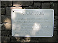
Plaque by the Stock Well
The Stock Well dates back to 1645 but is now sealed for safety. It is in a corner of the castle grounds below the Wesleyan chapel in Parson Lane - Image
The plaque reads:
STOCK WELL
The smallest of three Borough wells,
used until piped water was introduced in 1856.
It is first recorded in 1645.
The well was sealed in 1880 after two children
narrowly escaped drowning.
The adjoining field was Stock Well Meadow.
Image: © John S Turner
Taken: 28 Apr 2011
0.08 miles