
IMAGES TAKEN NEAR TO
Pendle Court, CLITHEROE, BB7 1PH
Introduction
This page details the photographs taken nearby to Pendle Court, BB7 1PH by members of the Geograph project.
The Geograph project started in 2005 with the aim of publishing, organising and preserving representative images for every square kilometre of Great Britain, Ireland and the Isle of Man.

There are currently over 7.5m images from over14,400 individuals and you can help contribute to the project by visiting https://www.geograph.org.uk
Image Map
Images are licensed for reuse under creativecommons.org/licenses/by-sa/2.0
Notes
- Clicking on the map will re-center to the selected point.
- The higher the marker number, the further away the image location is from the centre of the postcode.
Image Listing (195 Images Found)
Images are licensed for reuse under creativecommons.org/licenses/by-sa/2.0
Image
Details
Distance
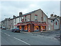
2
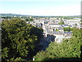
View from Clitheroe Castle
The Norman castle on the promontory overlooking Clitheroe was built by the de Lacy family about 1100. Its original purpose was to defend the cross Pennine trade route through the Ribble-Aire gap. The keep, which is now ruined, was one of the smallest in England, but at various periods there were other structures on the site, including the Chapel of St Michael, a jail, a courthouse, and a gatehouse.
Clitheroe Castle was a military stronghold and an administrative centre. A battle was fought here against an invading Scottish army in 1138 and it is believed that King Henry VIth was imprisoned in the castle during the Wars of the Roses. By 1602 the castle was described as 'very ruinous' but was refortified during the Civil War. Prince Rupert stayed here in 1644 but the garrison fled after Rupert's defeat at the Battle of Marston Moor.
In 1919 the site was purchased from Lord Montague by the people of Clitheroe to serve as a memorial to those of the town killed in the Great War. It provides fine views over Clitheroe and the hills beyond.
Image: © Marathon
Taken: 30 Aug 2018
0.04 miles
5
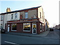
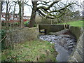
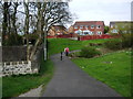
Alpe's the Butchers, Shawbridge Street, Clitheroe
Image: © Alexander P Kapp
Taken: 14 Apr 2010
0.05 miles
7
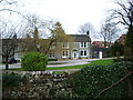
Ashgrove House
Built around 1681 as one building, with the part now called Shaw Cottage
Image: © Alexander P Kapp
Taken: 29 Feb 2008
0.06 miles
8
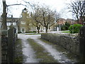
Shaw Cottage
The central part of the building it was built around 1680 when Edward Page was
given permission to build a house and barn at the Shay on the north-east side of Shaw Brook
Image: © Alexander P Kapp
Taken: 29 Feb 2008
0.06 miles
9
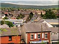
Clitheroe, from Castle Hill
A view towards Pendle Hill, looking over the town of Clitheroe from the steps leading up Castle Hill to Clitheroe Castle.
Image: © David Dixon
Taken: 16 Aug 2015
0.06 miles
10
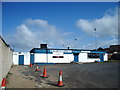
Clitheroe FC
Entrance to Shawbridge Football Ground home of Clitheroe FC
Image: © Alexander P Kapp
Taken: 4 Mar 2004
0.07 miles