
IMAGES TAKEN NEAR TO
Newton Street, CLITHEROE, BB7 1DD
Introduction
This page details the photographs taken nearby to Newton Street, BB7 1DD by members of the Geograph project.
The Geograph project started in 2005 with the aim of publishing, organising and preserving representative images for every square kilometre of Great Britain, Ireland and the Isle of Man.

There are currently over 7.5m images from over14,400 individuals and you can help contribute to the project by visiting https://www.geograph.org.uk
Image Map
Images are licensed for reuse under creativecommons.org/licenses/by-sa/2.0
Notes
- Clicking on the map will re-center to the selected point.
- The higher the marker number, the further away the image location is from the centre of the postcode.
Image Listing (116 Images Found)
Images are licensed for reuse under creativecommons.org/licenses/by-sa/2.0
Image
Details
Distance
2
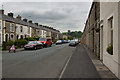
Woone Lane with a sight of Clitheroe Castle
Image: © Ian Greig
Taken: 30 May 2014
0.04 miles
3
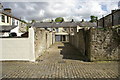
Back alley, Woone Lane area of Clitheroe
Image: © Alexander P Kapp
Taken: 19 May 2007
0.06 miles
5
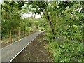
New path in Primrose Nature Reserve
The nature reserve occupies an area around the Mearley Brook and Primrose Lodge, a former mill dam that was used to power local mills from 1787 to as late as 1963 (information from an interpretation board on the site). This new path was not yet 'open'; photographed through Herras fencing.
Image: © Stephen Craven
Taken: 23 Aug 2022
0.09 miles
6
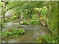
Sluices on Mearley Brook (1)
Within the Primrose Nature Reserve are sluices that took water from the brook to power local mills from 1787 to as late as 1963 (information from an interpretation board on the site).
Image: © Stephen Craven
Taken: 23 Aug 2022
0.10 miles
7
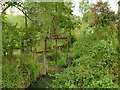
Sluices on Mearley Brook (2)
Within the Primrose Nature Reserve are sluices that took water from the brook to power local mills from 1787 to as late as 1963 (information from an interpretation board on the site).
Image: © Stephen Craven
Taken: 23 Aug 2022
0.10 miles
8
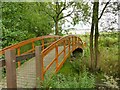
Footbridges in Primrose Nature Reserve
The nature reserve occupies an area around the Mearley Brook and Primrose Lodge, a former mill dam that was used to power local mills from 1787 to as late as 1963 (information from an interpretation board on the site).
Image: © Stephen Craven
Taken: 23 Aug 2022
0.10 miles
9
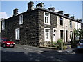
Terraced housing, Woone Lane, Clitheroe
Image: © Alexander P Kapp
Taken: 8 Jun 2007
0.11 miles
10

T. Heaton & Son, West View, Clitheroe
Image: © Alexander P Kapp
Taken: 10 Feb 2008
0.12 miles