IMAGES TAKEN NEAR TO
Rhuddlan Close, ROSSENDALE, BB4 6TF
Introduction
This page details the photographs taken nearby to Rhuddlan Close, BB4 6TF by members of the Geograph project.
The Geograph project started in 2005 with the aim of publishing, organising and preserving representative images for every square kilometre of Great Britain, Ireland and the Isle of Man.

There are currently over 7.5m images from over14,400 individuals and you can help contribute to the project by visiting https://www.geograph.org.uk
Image Map
Images are licensed for reuse under creativecommons.org/licenses/by-sa/2.0
Notes
- Clicking on the map will re-center to the selected point.
- The higher the marker number, the further away the image location is from the centre of the postcode.
Image Listing (75 Images Found)
Images are licensed for reuse under creativecommons.org/licenses/by-sa/2.0
Image
Details
Distance
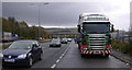
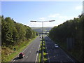
1
Haslingden Bypass (A56)
The bridge in the distance carries Helmshore Road over the bypass.
Image: © Robert Wade
Taken: 2 Nov 2008
0.04 miles
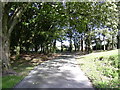
2
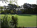
Bowling Green and Pavilion, Victoria Park
Image: © Robert Wade
Taken: 10 Oct 2008
0.06 miles
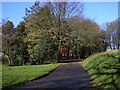
4
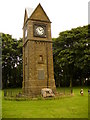
The Clock Tower, Victoria Park, Haslingden
This clock tower was erected in memory of Alderman W.H. Wilkinson 1850-1906, a native of Haslingden and General Secretary of the Northern Counties Weavers Amalgamation, who 'served his fellows with zeal and ability in many capacities'. Leaning against the foot of the tower is the base of the ancient Holden Cross. Image
Image: © Peter Worrell
Taken: 1 Jul 2007
0.10 miles
5
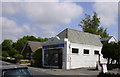
The Old Co-Op Flaxmoss Haslingden Rossendale
Now a hairdressers has served several purposes over the years
Image: © Robert Wade
Taken: 4 Jun 2007
0.10 miles
6
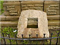
The base of the ancient Holden Cross
Leaning against the clock tower in Victoria Park is the base of Holden Cross, removed from its original position Image to the park about 1915 by Major Halstead M.P., Mayor of Haslingden, possibly to prevent vandalism. This cross used to be one of a line of ancient crosses marking the route from Manchester to Whalley Abbey, the base of next one in the line, the pilgrim's cross at Holcome was destroyed in 1901 by unknown hands.
Image: © Peter Worrell
Taken: 1 Jul 2007
0.10 miles
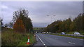
7
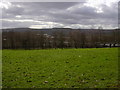
Victoria Park
The bridge carries Helmshore Road over the Haslingden By-pass (A56) Tor can be seen in the background.
Image: © Robert Wade
Taken: 17 Mar 2008
0.10 miles