The base of the ancient Holden Cross
Introduction
The photograph on this page of The base of the ancient Holden Cross by Peter Worrell as part of the Geograph project.
The Geograph project started in 2005 with the aim of publishing, organising and preserving representative images for every square kilometre of Great Britain, Ireland and the Isle of Man.

There are currently over 7.5m images from over 14,400 individuals and you can help contribute to the project by visiting https://www.geograph.org.uk
The base of the ancient Holden Cross
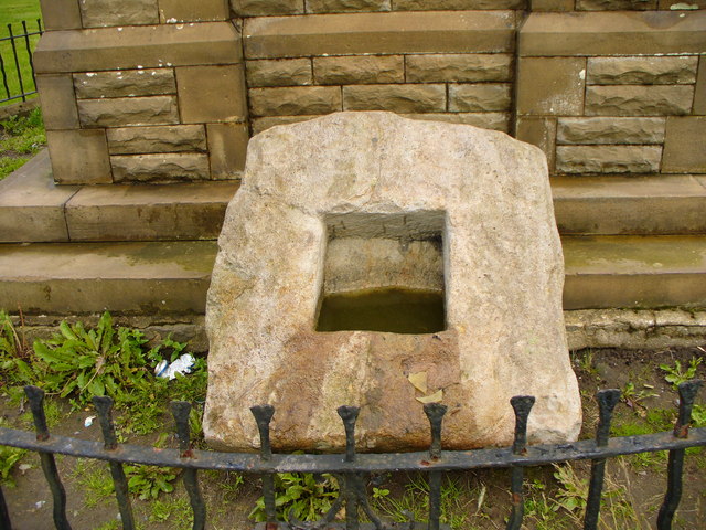
Image: © Peter Worrell Taken: 1 Jul 2007
Leaning against the clock tower in Victoria Park is the base of Holden Cross, removed from its original position Image to the park about 1915 by Major Halstead M.P., Mayor of Haslingden, possibly to prevent vandalism. This cross used to be one of a line of ancient crosses marking the route from Manchester to Whalley Abbey, the base of next one in the line, the pilgrim's cross at Holcome was destroyed in 1901 by unknown hands.
Images are licensed for reuse under creativecommons.org/licenses/by-sa/2.0
Image Location
Latitude
53.697326
Longitude
-2.325743