IMAGES TAKEN NEAR TO
Longsight Road, BLACKBURN, BB1 9ER

Introduction

This page details the photographs taken nearby to Longsight Road, BB1 9ER by members of the Geograph project.

The Geograph project started in 2005 with the aim of publishing, organising and preserving representative images for every square kilometre of Great Britain, Ireland and the Isle of Man.

There are currently over 7.5m images from over14,400 individuals and you can help contribute to the project by visiting https://www.geograph.org.uk

Image Map


Images are licensed for reuse under creativecommons.org/licenses/by-sa/2.0
Notes
  • Clicking on the map will re-center to the selected point.
  • The higher the marker number, the further away the image location is from the centre of the postcode.

Image Listing (11 Images Found)

Images are licensed for reuse under creativecommons.org/licenses/by-sa/2.0
Image
Details
Distance
1
Approaching Sykes Farm from the South East
On a public footpath from Wilpshire, heading towards Sykes Farm on the A59
Image: © Chris Heaton Taken: 20 Jul 2017
0.02 miles
2
Sykes Farm
Image: © Chris Heaton Taken: 20 Jul 2017
0.02 miles
3
Barn on the A59
At Sykes Farm east of Copster Green. The barn bears a plaque reading "E.A.Le G.S. AD 1904 - presumably the initials of the original owner, and the year of construction.
Image: © philandju Taken: 7 Sep 2012
0.03 miles
4
A59 eastbound near Sykes Farm
Image: © Colin Pyle Taken: 15 Nov 2014
0.04 miles
5
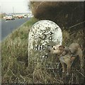
Old Milestone by the A59, Longsight Road, Copster Green
Whalley stone by the A59, in parish of Clayton-Le-Woods (Chorley District), Longsight Road, 20m West of Sykes Farm. Lost since 1992. Inscription reads:- : 10 / MILES / TO / PRESTON : : 3¾ / MILES / TO / WHALLEY : Milestone Society National ID: LA_PSCL10
Image: © Milestone Society Taken: Unknown
0.05 miles
6
Wheatley Farm
Off the A59 near Copster Green.
Image: © philandju Taken: 11 Aug 2022
0.07 miles
7
Old Boundary Marker by the A59, Longsight Road, Samlesbury Parish
Parish Boundary Marker by the A59, in parish of Samlesbury (Ribble Valley District), 50m East of Sykes Farm, on verge by Dinckley Brook, South side of road. Surveyed Milestone Society National ID: LA_PSCL10pb
Image: © Philip Platt Taken: Unknown
0.08 miles
8
A59 near Sykes Farm
Image: © Anthony Parkes Taken: 29 Jun 2012
0.11 miles
9
Copster Green
The North end of Copster Green village with Pendle Hill behind. Note the traffic cameras on this stretch of the A59
Image: © michael hardman Taken: 24 Nov 2005
0.22 miles
10
Copster Green
Image: © Anthony Parkes Taken: 29 Jun 2012
0.23 miles