
IMAGES TAKEN NEAR TO
Revidge Road, BLACKBURN, BB1 8DF
Introduction
This page details the photographs taken nearby to Revidge Road, BB1 8DF by members of the Geograph project.
The Geograph project started in 2005 with the aim of publishing, organising and preserving representative images for every square kilometre of Great Britain, Ireland and the Isle of Man.

There are currently over 7.5m images from over14,400 individuals and you can help contribute to the project by visiting https://www.geograph.org.uk
Image Map
Images are licensed for reuse under creativecommons.org/licenses/by-sa/2.0
Notes
- Clicking on the map will re-center to the selected point.
- The higher the marker number, the further away the image location is from the centre of the postcode.
Image Listing (32 Images Found)
Images are licensed for reuse under creativecommons.org/licenses/by-sa/2.0
Image
Details
Distance
1
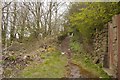
Path to The Tank
Off Revidge Road to a very fine viewpoint.
Image: © Richard Webb
Taken: 4 Apr 2019
0.04 miles
2
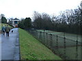
Tennis courts-Corporation Park
Two brave lads actually playing on this cold January day!!
Image: © Tony Mercer
Taken: 25 Jan 2009
0.04 miles
3
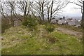
The Tank, Revidge
The summit of Revidge was once the site of a 227,000l / 50,000 gallon water tank supplying the higher parts of Blackburn. It was removed in 2001 and there is now a toposcope here. The view is rather fine.
Image: © Richard Webb
Taken: 4 Apr 2019
0.06 miles
4
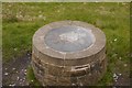
The Tank toposcope
The summit of Revidge was once the site of a 227,000l / 50,000 gallon water tank supplying the higher parts of Blackburn. It was removed in 2001 and replaced by this toposcope. The view is rather fine.
Image: © Richard Webb
Taken: 4 Apr 2019
0.06 miles
5
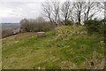
The Tank
The summit of Revidge was once the site of a 227,000l / 50,000 gallon water tank supplying the higher parts of Blackburn. It was removed in 2001 and there is now a toposcope here. The view is rather fine.
Image: © Richard Webb
Taken: 4 Apr 2019
0.07 miles
6
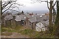
View from The Tank
Looking over Revidge Road houses towards the centre of Blackburn.
Image: © Richard Webb
Taken: 4 Apr 2019
0.07 miles
7
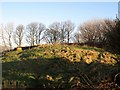
Revidge Summit
Revidge, 229 metres and a P55 hill near Blackburn.
Image: © Rude Health
Taken: 6 Feb 2012
0.08 miles
8
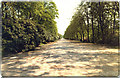
The Broad Walk, Corporation Park, Blackburn
This is where the Victorians and Edwardians would promenade
Image: © Malcolm Morris
Taken: 5 Jul 1987
0.13 miles
9
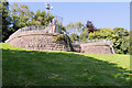
Colourfields, the Panopticon in Corporation Park
This battlement viewing platform stands more than 200 metres above sea level allowing long views over Blackburn and the West Pennine Moors. The stone barrage formerly hosted two trophy Russian cannons captured during the siege of Sebastopol https://en.wikipedia.org/wiki/Siege_of_Sevastopol_(1854%E2%80%931855) and presented to the town by Lord Panmure, the Secretary of War, as a reminder of the British victories in the Crimean War https://en.wikipedia.org/wiki/Crimean_War and they were mounted at the top of the park in 1857 on this specially built 'battery'.
The cannons have since been removed and, in 2006, the stone battery was developed into ‘Colourfields’, the first in a series of landmarks called 'Panopticons' - a project of the East Lancashire Environmental Arts Network.
Image: © David Dixon
Taken: 13 Sep 2020
0.14 miles
10
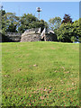
Gun Battery in Corporation Park
This battlement viewing platform stands more than 200 metres above sea level allowing long views over Blackburn and the West Pennine Moors. The stone barrage formerly hosted two trophy Russian cannons captured during the siege of Sebastopol https://en.wikipedia.org/wiki/Siege_of_Sevastopol_(1854%E2%80%931855) and presented to the town by Lord Panmure, the Secretary of War, as a reminder of the British victories in the Crimean War https://en.wikipedia.org/wiki/Crimean_War and they were mounted at the top of the park in 1857 on this specially built 'battery'.
The cannons have since been removed and, in 2006, the stone battery was developed into ‘Colourfields’, the first in a series of landmarks called 'Panopticons' - a project of the East Lancashire Environmental Arts Network.
Image: © David Dixon
Taken: 13 Sep 2020
0.14 miles