
IMAGES TAKEN NEAR TO
Dale View, BARNOLDSWICK, BB18 5PQ
Introduction
This page details the photographs taken nearby to Dale View, BB18 5PQ by members of the Geograph project.
The Geograph project started in 2005 with the aim of publishing, organising and preserving representative images for every square kilometre of Great Britain, Ireland and the Isle of Man.

There are currently over 7.5m images from over14,400 individuals and you can help contribute to the project by visiting https://www.geograph.org.uk
Image Map
Images are licensed for reuse under creativecommons.org/licenses/by-sa/2.0
Notes
- Clicking on the map will re-center to the selected point.
- The higher the marker number, the further away the image location is from the centre of the postcode.
Image Listing (330 Images Found)
Images are licensed for reuse under creativecommons.org/licenses/by-sa/2.0
Image
Details
Distance
1
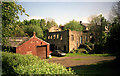
Ouzledale, Barnoldswick
The ruined building was first a sawmill, then an iron foundry: the company continues in business elsewhere in Barnoldswick.
Image: © Dr Neil Clifton
Taken: Unknown
0.01 miles
2
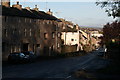
Manchester Road, Barnoldswick
Using a longer lens than Image
Image: © Dr Neil Clifton
Taken: 30 Oct 2007
0.04 miles
3

Low Moor Lane, Barnoldswick
Low Moor Lane is a track which runs parallel to, and west of, Manchester Road.
Image: © Dr Neil Clifton
Taken: 30 Oct 2007
0.04 miles
4
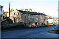
Manchester Road, Barnoldswick
Looking northwards from the end of Park Avenue
Image: © Dr Neil Clifton
Taken: 30 Oct 2007
0.04 miles
5
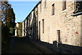
Crowfoot Row, Longfield Lane, Barnoldswick
Longfield Lane is really only a footpath: although part of it is cobbled, it is not wide enough for vehicles, and furthermore there are steps. This old row of cottages at the eastern end lie on the lane, but their address is Crowfoot Row. They are some of Barnoldswick's oldest surviving cottages.
Image: © Dr Neil Clifton
Taken: 30 Oct 2007
0.04 miles
6
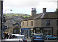
From Church Street to Weets Hill, Barnoldswick
Barnoldswick's Church Street is a busy street with motor traffic most of the day, but open country is not far away as steep streets climb towards the backdrop of Weets Hill.
Image: © Dr Neil Clifton
Taken: 9 Oct 2006
0.05 miles
7
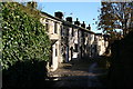
Crowfoot Row, Barnoldswick
This is looking eastwards along the cobbled part of Longfield Lane where the Crowfoot Row cottages are situated.
Image: © Dr Neil Clifton
Taken: 30 Oct 2007
0.05 miles
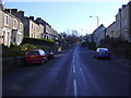
9
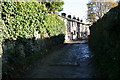
Longfield Lane, Barnoldswick
Looking eastwards along the lane, this shows where the cobbled portion ends.
Image: © Dr Neil Clifton
Taken: 30 Oct 2007
0.05 miles
10
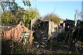
Ouzeldale, Barnoldswick (1)
This ruined building in the valley of Gillians Beck first housed a sawmill and later and iron foundry, but following flood damage, the company relocated many years ago to a different part of the town, (still retaining, interestingly, the name 'Ouzeldale').
Image: © Dr Neil Clifton
Taken: 30 Oct 2007
0.05 miles