1
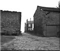
Skipton Road, Barnoldswick
Image: © Ian S
Taken: 25 Sep 2010
0.01 miles
2
Back passage in Barnoldswick
Quite a wide one off Skipton Road.
Image: © Bill Boaden
Taken: 3 Dec 2016
0.01 miles
3
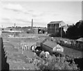
View near the old Barnoldswick gasworks
This area is now redeveloped
Image: © Dr Neil Clifton
Taken: 10 Oct 1982
0.02 miles
4
Barnoldswick: The old corn mill from West Close Road
New housing development has taken place near to the old corn mill, which is a Listed Building so cannot be demolished. The brick building in the foreground is not listed.
Image: © Dr Neil Clifton
Taken: 7 Feb 2010
0.02 miles
5
Off Skipton Rd
Image: © N Chadwick
Taken: 8 Apr 2015
0.02 miles
6
Skipton Road and Gisburn Road School, Barnoldswick
Just behind the furthest white van is a mini-roundabout which marks the beginning of Gisburn Road, which runs off to the right. Skipton Road continues to the left towards the Town Centre.
Image: © Dr Neil Clifton
Taken: 10 Sep 2008
0.03 miles
7
Unadopted road on Barnoldswick
There is a northern feel to this road, which runs off Skipton Road.
Image: © Bill Boaden
Taken: 3 Dec 2016
0.05 miles
8
Skipton Road, Barnoldswick, Yorkshire
This is the part of Skipton Road just north-east of where Gisburn Road joins at a mini-roundabout. The first building on the left is known as Victoria Court. Beyond that on the left hand side of Skipton Road is the junction with Lower North Avenue. Skipton Road is the B6252, and joins the A56 at Thornton-in-Craven.
Image: © Dr Neil Clifton
Taken: 7 Jul 2007
0.05 miles
9
Barnoldswick's oldest mill
Originally a corn mill and water-powered from a reservoir that was situated between where the photographer is standing and the mill itself. It is difficult to photograph this historic building well: this was taken from the allotment path using a long lens.
Conversion of the mill into apartments is intended.
Image: © Dr Neil Clifton
Taken: 8 Jul 2007
0.05 miles
10
Site of former mill dam, Barnoldswick
The mill shown here is Barnoldswick's oldest, which was originally a water-powered corn mill. The mill dam, which was fed from Butts Beck by a leat, the course of which is still visible in the Butts Gardens, occupied the area shown here. In later years, the dam was emptied and the area it occupied is now used for allotments.
Image: © Dr Neil Clifton
Taken: 24 Oct 1997
0.05 miles


