1
A Victorian Jubilee seat
A metal bench is fitted with a plate, marking Queen Victoria's Jubilee, 1837-97. It now stands beside the junction with Eastfield Road; the latter is a new creation, as the land beyond was once the estate of Hill House.
Image: © Neil Owen
Taken: 18 Apr 2024
0.06 miles
2
A footpath off Grant's Lane
Take the footpath over the field and enjoy a high view over the north of Wincanton, including the race course. Windmill Hill was also the site of a cricket ground in days past.
Image: © Neil Owen
Taken: 18 Apr 2024
0.07 miles
3
The Orange Way in Dorset and Somerset (267)
This footpath sign on Ireson Lane shows the waymark for the Monarch's Way.
Image: © Shazz
Taken: 24 Sep 2012
0.07 miles
4
New houses along Bayford Hill
Wincanton is a growing town and this former field on the road east is now being developed for housing.
Image: © Neil Owen
Taken: 18 Apr 2024
0.08 miles
5
The Orange Way in Dorset and Somerset (268)
This is the end of Ireson Lane and the Orange Way goes on the footpath to the right.
Image: © Shazz
Taken: 24 Sep 2012
0.11 miles
6
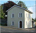
Old Toll House, Wincanton
Toll House in the parish of Wincanton, The Old Toll House, East Gate, 68, High Street, BA9 9LR.
Grade II listed.
List Entry Number: 1274057 https://historicengland.org.uk/listing/the-list/list-entry/1274057
Surveyed
Milestone Society National ID: SO.WIN
Image: © Alan Rosevear
Taken: Unknown
0.12 miles
7
The Orange Way in Dorset and Somerset (265)
This was taken with the camera in Common Lane, looking across Wincanton High Street (left) and Bayford Hill (right) into Ireson Lane.
Image: © Shazz
Taken: 24 Sep 2012
0.12 miles
8
Benchmark on #83 High Street, Wincanton
Very worn Ordnance Survey benchmark, described on database at http://www.bench-marks.org.uk/bm48211.
Image: © Becky Williamson
Taken: 3 Sep 2015
0.12 miles
9
The Orange Way in Dorset and Somerset (266)
Image: © Shazz
Taken: 24 Sep 2012
0.12 miles
10
Benchmark at the corner of Ireson Lane
A faded cutmark, as listed in the Benchmark Database: https://www.bench-marks.org.uk/bm48211 , on the corner of a house at the end of the High Street. See
Image] for a wider view.
Image: © Neil Owen
Taken: 18 Apr 2024
0.13 miles


