
IMAGES TAKEN NEAR TO
Shepton Montague, WINCANTON, BA9 8JE
Introduction
This page details the photographs taken nearby to BA9 8JE by members of the Geograph project.
The Geograph project started in 2005 with the aim of publishing, organising and preserving representative images for every square kilometre of Great Britain, Ireland and the Isle of Man.

There are currently over 7.5m images from over14,400 individuals and you can help contribute to the project by visiting https://www.geograph.org.uk
Image Map
Images are licensed for reuse under creativecommons.org/licenses/by-sa/2.0
Notes
- Clicking on the map will re-center to the selected point.
- The higher the marker number, the further away the image location is from the centre of the postcode.
Image Listing (12 Images Found)
Images are licensed for reuse under creativecommons.org/licenses/by-sa/2.0
Image
Details
Distance


5

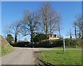
Shepton Montague: Dismantled railway bridge
Image: © Michael Garlick
Taken: 15 Jul 2025
0.17 miles
6
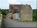
Shepton Montague village hall
Built as a school in 1846, it closed in 1919 and became the village hall in 1993. What was it in the interim?
Image: © Robin Webster
Taken: 10 Jun 2018
0.21 miles
7
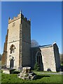
Church of Saint Peter, Shepton Montague
Image: © Roger Cornfoot
Taken: 7 Mar 2022
0.21 miles
9
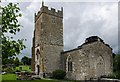
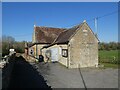
Shepton Montague: Church of Saint Peter
The Parish Church of Saint Peter has 13th century origins and has been designated as a Grade II listed building. It was seriously damaged by a fire in 1964 and restored two years later.
Image: © Mr Eugene Birchall
Taken: 17 Jun 2012
0.22 miles
10
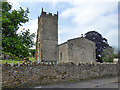
Shepton Montague church
St. Peter's is a grade II listed building.
Image: © Robin Webster
Taken: 10 Jun 2018
0.22 miles