
IMAGES TAKEN NEAR TO
Verrington, WINCANTON, BA9 8BW
Introduction
This page details the photographs taken nearby to BA9 8BW by members of the Geograph project.
The Geograph project started in 2005 with the aim of publishing, organising and preserving representative images for every square kilometre of Great Britain, Ireland and the Isle of Man.

There are currently over 7.5m images from over14,400 individuals and you can help contribute to the project by visiting https://www.geograph.org.uk
Image Map
Images are licensed for reuse under creativecommons.org/licenses/by-sa/2.0
Notes
- Clicking on the map will re-center to the selected point.
- The higher the marker number, the further away the image location is from the centre of the postcode.
Image Listing (15 Images Found)
Images are licensed for reuse under creativecommons.org/licenses/by-sa/2.0
Image
Details
Distance
1
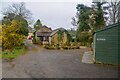
Wincanton : The Old Barns
The right of way heads alongside The Old Barns.
Image: © Lewis Clarke
Taken: 20 Mar 2023
0.02 miles
2
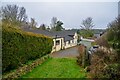
Wincanton : The Old Barns
Looking to houses in the countryside.
Image: © Lewis Clarke
Taken: 20 Mar 2023
0.02 miles
3
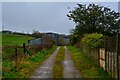
Wincanton : Track
A track heading to The Old Barns.
Image: © Lewis Clarke
Taken: 20 Mar 2023
0.05 miles

5
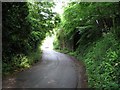
Dismantled Railway Bridge, Verrington Lane
Dismantled bridge that used to carry railway (now also dismantled) over Verrington Lane.
Image: © william
Taken: 31 May 2007
0.08 miles

7

Wincanton : Dancing Hill
A footpath heading fown the hill to Verrington Lane.
Image: © Lewis Clarke
Taken: 20 Mar 2023
0.14 miles
8

Wincanton : Wincanton Community Hospital
Wincanton Community Hospital on Dancing Lane.
Image: © Lewis Clarke
Taken: 20 Mar 2023
0.15 miles
9
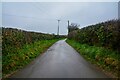
Charlton Musgrove : Lane
A lane heading off Old Hill.
Image: © Lewis Clarke
Taken: 20 Mar 2023
0.17 miles
10
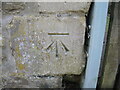
A Shadwell benchmark
A cutmark, as listed in the Benchmark Database: https://www.bench-marks.org.uk/bm60457 on a house wall along the B3081. See Image] for a wider view.
Image: © Neil Owen
Taken: 18 Apr 2024
0.19 miles