IMAGES TAKEN NEAR TO
Juniper Road, BA7 7GF
Introduction
This page details the photographs taken nearby to Juniper Road, BA7 7GF by members of the Geograph project.
The Geograph project started in 2005 with the aim of publishing, organising and preserving representative images for every square kilometre of Great Britain, Ireland and the Isle of Man.

There are currently over 7.5m images from over14,400 individuals and you can help contribute to the project by visiting https://www.geograph.org.uk
Image Map
Images are licensed for reuse under creativecommons.org/licenses/by-sa/2.0
Notes
- Clicking on the map will re-center to the selected point.
- The higher the marker number, the further away the image location is from the centre of the postcode.
Image Listing (15 Images Found)
Images are licensed for reuse under creativecommons.org/licenses/by-sa/2.0
Image
Details
Distance
1
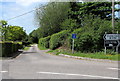
No through lane west of Station Road, Castle Cary
The 275 metre long lane ends near a railway ahead.
Image: © Jaggery
Taken: 4 Jun 2015
0.14 miles
2
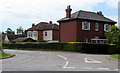
Station Road houses near Ansford Hill, Castle Cary
The nearest house is on the corner of this http://www.geograph.org.uk/photo/4510313 lane.
Image: © Jaggery
Taken: 4 Jun 2015
0.15 miles
4
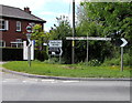
Older-style long-arm signpost in Castle Cary
At the junction of Station Road and Ansford Hill.
Image: © Jaggery
Taken: 4 Jun 2015
0.18 miles
5
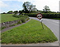
Wonky traffic sign at the bottom of Ansford Hill, Castle Cary
No longer vertical, the sign shows no overtaking for 275 yards ahead.
Image: © Jaggery
Taken: 4 Jun 2015
0.18 miles
6

Left here for Castle Cary railway station
The sign is at the junction of Station Road and Ansford Hill. Castle Cary railway station is at the northern
edge of town, nearly 2km (a little over a mile) by road to Market Place in the centre of Castle Cary.
Walkers can use a slightly shorter route via a path at the SE edge of the station.
Image: © Jaggery
Taken: 4 Jun 2015
0.18 miles

9

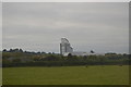
Major development proposed for this green field in Castle Cary
Viewed from a Station Road field gate in early June 2015. A South Somerset District Council notice on the gate gives details of a proposed residential development of up to 75 dwellings on this site, with associated means of access etc. Details of how to comment on the proposal, and by when, are shown on the notice.
Image: © Jaggery
Taken: 4 Jun 2015
0.20 miles