
IMAGES TAKEN NEAR TO
Rebels Way, GLASTONBURY, BA6 9QD
Introduction
This page details the photographs taken nearby to Rebels Way, BA6 9QD by members of the Geograph project.
The Geograph project started in 2005 with the aim of publishing, organising and preserving representative images for every square kilometre of Great Britain, Ireland and the Isle of Man.

There are currently over 7.5m images from over14,400 individuals and you can help contribute to the project by visiting https://www.geograph.org.uk
Image Map
Images are licensed for reuse under creativecommons.org/licenses/by-sa/2.0
Notes
- Clicking on the map will re-center to the selected point.
- The higher the marker number, the further away the image location is from the centre of the postcode.
Image Listing (148 Images Found)
Images are licensed for reuse under creativecommons.org/licenses/by-sa/2.0
Image
Details
Distance
1
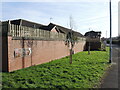
An unusual sign on Feversham Lane
It can't be many fish and chip shops that have a brown English tourism sign dedicated to them.
Image: © Neil Owen
Taken: 1 Feb 2024
0.08 miles
2
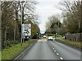
A39, Glastonbury Bypass
The Glastonbury Bypass opened in the late 1990s, here it is approaching Northload Bridge Roundabout.
Image: © David Dixon
Taken: 10 Dec 2013
0.11 miles
3
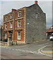
Corner of Norlet Court and Northload Street, Glastonbury
Viewed across Northload Street.
Image: © Jaggery
Taken: 7 Jul 2010
0.12 miles
4

The Tanneries, Glastonbury
House on the corner of Northload Street and Sedgemoor Way.
Image: © Jaggery
Taken: 7 Jul 2010
0.12 miles
5
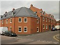
New housing, Glastonbury
Recently-built houses on the corner of George Street and Northload Street.
Image: © Jaggery
Taken: 7 Jul 2010
0.13 miles
6
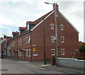
Coachman's Yard, Glastonbury
Modern housing on the west side of Northload Street, opposite George Street.
Image: © Jaggery
Taken: 7 Jul 2010
0.13 miles
7

Glastonbury - City Of Light
A new age place of self enlightenment based in the former St Michaels chapel.
Image: © Chris Talbot
Taken: 15 Oct 2011
0.13 miles
8
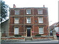
Northload Hall
Northload Hall. An old Hall left to the Town by a previous owner, formerly used as Social Services offices and now converted into 9 flats.
Image: © Graham Lucas
Taken: 13 Aug 2008
0.14 miles
9
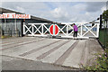
Dye House Lane Crossing
Although all trace of Glastonbury Station has vanished, a reminder of the railway's course is to be seen close to the A39 roundabout near the Glastonbury factory estate. The new bypass, in fact, uses the course of the old railway around the town.Here a new set of gates have been erected at the point where the track crossed Dye House Lane. The ironwork from the original trackbed is visible in the roadway.
Image: © Richard Bird
Taken: 19 Jun 2011
0.15 miles
10
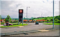
Roundabout junction of A39 and A361 roads, near site of Glastonbury station
View NE, to Glastonbury Tor in the distance. Glastonbury & Street station had been 100-200 yards behind here and the ex-Somerset & Dorset line, Burnham-on-Sea - Highbridge - Evercreech Junction (closed 7/3/66), would have run along on the left, also throwing off a branch to Wells (closed 29/10/51) to the left just ahead. Note the price of petrol in 2001.
Image: © Ben Brooksbank
Taken: 16 May 2001
0.15 miles