
Dye House Lane Crossing
Introduction
The photograph on this page of Dye House Lane Crossing by Richard Bird as part of the Geograph project.
The Geograph project started in 2005 with the aim of publishing, organising and preserving representative images for every square kilometre of Great Britain, Ireland and the Isle of Man.

There are currently over 7.5m images from over 14,400 individuals and you can help contribute to the project by visiting https://www.geograph.org.uk
Dye House Lane Crossing
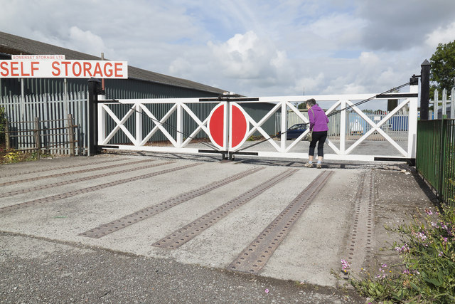
Image: © Richard Bird Taken: 19 Jun 2011
Although all trace of Glastonbury Station has vanished, a reminder of the railway's course is to be seen close to the A39 roundabout near the Glastonbury factory estate. The new bypass, in fact, uses the course of the old railway around the town.Here a new set of gates have been erected at the point where the track crossed Dye House Lane. The ironwork from the original trackbed is visible in the roadway.
Images are licensed for reuse under creativecommons.org/licenses/by-sa/2.0
Image Location

Latitude
51.148003
Longitude
-2.726349