IMAGES TAKEN NEAR TO
Millbatch Close, GLASTONBURY, BA6 9GT
Introduction
This page details the photographs taken nearby to Millbatch Close, BA6 9GT by members of the Geograph project.
The Geograph project started in 2005 with the aim of publishing, organising and preserving representative images for every square kilometre of Great Britain, Ireland and the Isle of Man.

There are currently over 7.5m images from over14,400 individuals and you can help contribute to the project by visiting https://www.geograph.org.uk
Image Map
Images are licensed for reuse under creativecommons.org/licenses/by-sa/2.0
Notes
- Clicking on the map will re-center to the selected point.
- The higher the marker number, the further away the image location is from the centre of the postcode.
Image Listing (39 Images Found)
Images are licensed for reuse under creativecommons.org/licenses/by-sa/2.0
Image
Details
Distance

3
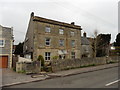
Abbot's Way School
Occupying the old vicarage, the school is dedicated to providing education for young people with Specific Learning Differences.
Image: © Neil Owen
Taken: 24 Jul 2022
0.08 miles
4
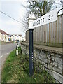
Meare - Ashcott Road End
In the centre of the village of Meare is a typical Somerset County Council signpost with its pyramidal finial.
Image: © Colin Smith
Taken: 30 Mar 2022
0.09 miles
5
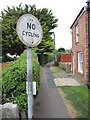
Old sign on Church Path
An old 'No Cycling' sign remains despite now being superseded by more modern designs. Note the text is actually embossed in a cast plate.
Image: © Neil Owen
Taken: 24 Jul 2022
0.09 miles
6
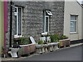
A convenient planter
Some disused toilet pans are lined up outside a house to afford some floral colour, alongside the painted fencing. They seem to have grown in numbers over recent years - perhaps they have good fertiliser.
Image: © Neil Owen
Taken: 24 Jul 2022
0.09 miles
7
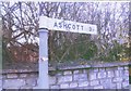
Direction Sign - Signpost by the B3151
Lost finial - 1 arm; Somerset SCC pyramid by the B3151, in parish of Meare (Mendip District), St Mary's Road junction with Ashcott Road.
Surveyed
Milestone Society National ID: SO_ST4541
Image: © Milestone Society
Taken: Unknown
0.09 miles
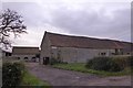
9
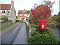
Meare: postbox № BA6 162
This postbox stands outside Image, which can be seen in the distance. It is emptied finally at 4:30pm on weekdays and at 10:15am on Saturdays.
Image: © Chris Downer
Taken: 24 Oct 2009
0.11 miles