
IMAGES TAKEN NEAR TO
WELLS, BA5 2QE
Introduction
This page details the photographs taken nearby to BA5 2QE by members of the Geograph project.
The Geograph project started in 2005 with the aim of publishing, organising and preserving representative images for every square kilometre of Great Britain, Ireland and the Isle of Man.

There are currently over 7.5m images from over14,400 individuals and you can help contribute to the project by visiting https://www.geograph.org.uk
Image Map
Images are licensed for reuse under creativecommons.org/licenses/by-sa/2.0
Notes
- Clicking on the map will re-center to the selected point.
- The higher the marker number, the further away the image location is from the centre of the postcode.
Image Listing (506 Images Found)
Images are licensed for reuse under creativecommons.org/licenses/by-sa/2.0
Image
Details
Distance
1
![Wells buildings [1]](https://s1.geograph.org.uk/geophotos/06/27/91/6279125_d19e823c_120x120.jpg)
Wells buildings [1]
The Old Almshouse is also known as Bubwith Almshouse after building commenced with an endowment from Bishop Bubwith. Building started in 1436, there were extensions in 1614 and again in 1638 and there was a major restoration in 1884. Listed, grade II*, with details at: https://historicengland.org.uk/listing/the-list/list-entry/1382942
A Roman settlement around three wells that became much more important when the Anglo-Saxon King Ine of Wessex founded a minster church in 704, Wells is the second smallest city in England.
Image: © Michael Dibb
Taken: 23 Aug 2019
0.00 miles
2

The Globe Inn
The Globe lies is Priest's Row opposite St Cuthbert's church near the junction with Chamberlain street.
Image: © Sharon Loxton
Taken: 18 Jun 2006
0.01 miles
3
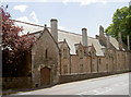
The old almshouses
Wells has a generous history of providing shelter for its less fortunate citizens. This row of almshouses in Chamberlain Street is the current version of homes originally started in 1436. Bishop Still left in his will of 1614 the provision for more houses here, also known as Bubwith Almshouses. The trustees approved a major rebuilding in 1884, which are seen here. The almshouses are Grade II* listed. See Image] for a look at the other side.
Image: © Neil Owen
Taken: 24 Jun 2014
0.01 miles
4
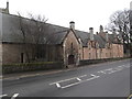
Bubwiths Almshouses, Wells
On Chamberlain Street.
Image: © Eirian Evans
Taken: 6 Feb 2017
0.01 miles
5
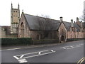
Bubwiths Almshouses
Almshouses on Chamberlain Street, with St Cuthbert's Church behind them.
Image: © Eirian Evans
Taken: 6 Feb 2017
0.01 miles
6
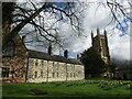
Wells - Wills Almshouses
Historic buildings beside St Cuthbert's Church.
www.wellssomerset.com
Image: © Colin Smith
Taken: 31 Mar 2022
0.01 miles
7
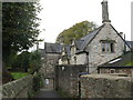
Wells Old Almshouses
Three small ranges dating variously from 1615 [Still's], 1637 [Bricke's] and 1777 [Willes'], and dating originally from 1436.
Image: © M J Richardson
Taken: 30 Oct 2013
0.01 miles
8
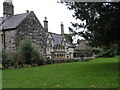
Almshouses overlooking St Cuthbert's Churchyard
Image: © Geoff Harris
Taken: 2 Nov 2008
0.02 miles
10

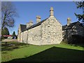
Wells, Chamberlain Road
This photograph Image shows a view of Whiting Road.
Image: © Chris' Buet
Taken: 7 Aug 2014
0.02 miles