
IMAGES TAKEN NEAR TO
Woolcombe Road, WELLS, BA5 2GZ
Introduction
This page details the photographs taken nearby to Woolcombe Road, BA5 2GZ by members of the Geograph project.
The Geograph project started in 2005 with the aim of publishing, organising and preserving representative images for every square kilometre of Great Britain, Ireland and the Isle of Man.

There are currently over 7.5m images from over14,400 individuals and you can help contribute to the project by visiting https://www.geograph.org.uk
Image Map
Images are licensed for reuse under creativecommons.org/licenses/by-sa/2.0
Notes
- Clicking on the map will re-center to the selected point.
- The higher the marker number, the further away the image location is from the centre of the postcode.
Image Listing (9 Images Found)
Images are licensed for reuse under creativecommons.org/licenses/by-sa/2.0
Image
Details
Distance
1
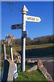
Old Direction Sign - Signpost by Glencot Road, St Cuthbert Out Parish
Pyramid finial - 3 arms; Somerset SCC pyramid by the UC road, in parish of St Cuthbert Out (Mendip District), Glencot Road, junction with Wells Road and Wookey Hole Road.
Surveyed
Milestone Society National ID: SO_ST5346A.
Image: © Milestone Society
Taken: 2 Feb 2013
0.18 miles
2

Trackbed of the old railway line to Wells
Image: © Roger Cornfoot
Taken: 17 Aug 2020
0.19 miles
3
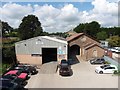
The old goods depot at Wookey Railway Station
Closed in the mid-1960's: Image
Image: © Roger Cornfoot
Taken: 17 Aug 2020
0.22 miles
4
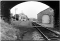
Wookey Station (Haybridge)
Wookey Station shortly after closure taken from Wells side looking towards Cheddar with Goods Shed on the right. Approx 1965
Image: © b Lewis
Taken: Unknown
0.22 miles

6

Direction Sign - Signpost south of Wookey Hole
Pyramid finial - 3 arms; Somerset SCC pyramid by the UC road, in parish of St Cuthbert Out (Mendip District), on the southeast side of the T junction of Glencot Lane, Glencot Road and a lane to the A371.
surveyed
Milestone Society National ID: SO_ST5346B
Image: © Milestone Society
Taken: 2 Feb 2013
0.23 miles
7
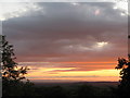
Sunset from Milton Hill
The picture was taken from beside Underwood quarry. The hills in the right background are the Quantocks.
Image: © Sharon Loxton
Taken: 29 Aug 2007
0.23 miles
8
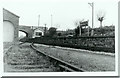
Wookey Station (Haybridge)
Picture taken shortly after closure of the 'Strawberry Line' looking towards Wells. Although called Wookey the station was actually at the hamlet of Haybridge, midway between Wookey and Wookey Hole. Date approximate.
Image: © b Lewis
Taken: Unknown
0.24 miles
9
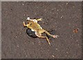
Squashed frog, Wells
Apologies for this picture, which was the best exposed I took all day. What is really tragic is the way she seems to be lifting a front leg to ask "if you don't mind, could I just cross the road?" The road in question was St Cuthbert Way at its junction with St Cuthbert Avenue.
Image: © Derek Harper
Taken: 22 Feb 2010
0.25 miles