Wookey Station (Haybridge)
Introduction
The photograph on this page of Wookey Station (Haybridge) by b Lewis as part of the Geograph project.
The Geograph project started in 2005 with the aim of publishing, organising and preserving representative images for every square kilometre of Great Britain, Ireland and the Isle of Man.

There are currently over 7.5m images from over 14,400 individuals and you can help contribute to the project by visiting https://www.geograph.org.uk
Wookey Station (Haybridge)
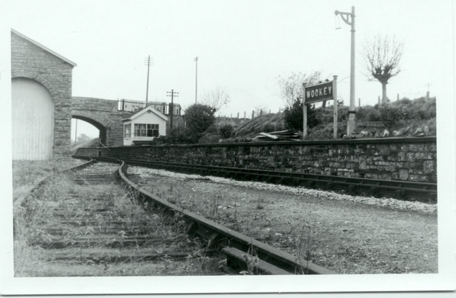
Image: © b Lewis Taken: Unknown
Picture taken shortly after closure of the 'Strawberry Line' looking towards Wells. Although called Wookey the station was actually at the hamlet of Haybridge, midway between Wookey and Wookey Hole. Date approximate.
Images are licensed for reuse under creativecommons.org/licenses/by-sa/2.0
Image Location
Latitude
51.214056
Longitude
-2.672697