IMAGES TAKEN NEAR TO
Chesterblade, SHEPTON MALLET, BA4 4QZ
Introduction
This page details the photographs taken nearby to BA4 4QZ by members of the Geograph project.
The Geograph project started in 2005 with the aim of publishing, organising and preserving representative images for every square kilometre of Great Britain, Ireland and the Isle of Man.

There are currently over 7.5m images from over14,400 individuals and you can help contribute to the project by visiting https://www.geograph.org.uk
Image Map
Images are licensed for reuse under creativecommons.org/licenses/by-sa/2.0
Notes
- Clicking on the map will re-center to the selected point.
- The higher the marker number, the further away the image location is from the centre of the postcode.
Image Listing (6 Images Found)
Images are licensed for reuse under creativecommons.org/licenses/by-sa/2.0
Image
Details
Distance
2

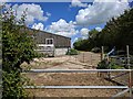
2011 : Beefburgers on the hoof, Winterwell Farm
My first thought was that it was a herd of cows bringing themselves in for milking. Closer inspection revealed them to be bullocks - not much milk from that lot then.
As a further clue "Where's the Path" marks a beef unit.
The map below claims there is a hotel here - not inclined to believe that.
Image: © Maurice Pullin
Taken: 9 Aug 2011
0.09 miles
3
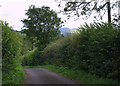
2011 : Winterwell Lane near Winterwell Farm
Heading south to Chesterblade.
Image: © Maurice Pullin
Taken: 9 Aug 2011
0.11 miles
4

2011 : South from Winterwell Lane
Farmland in sunshine and shadow.
Buildings to the far left are on the edge of Chesterblade.
Maes Down is to the right.
Image: © Maurice Pullin
Taken: 9 Aug 2011
0.18 miles
5
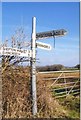
Direction Sign - Signpost on Brottens Road
Lost finial - 3 arms; Somerset SCC pyramid by the UC road, in parish of Evercreech (Mendip District), on the north side of the T junction of Brottens Road and Winterwell Lane, north of Chesterblade.
surveyed
Milestone Society National ID: SO_ST6542
Image: © Milestone Society
Taken: 15 Feb 2013
0.20 miles
6
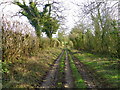
Holcombe Lane
The track, known as Holcombe Lane heads from Brottons Road to Maesdown Hill.
Image: © Maigheach-gheal
Taken: 7 Mar 2012
0.23 miles