IMAGES TAKEN NEAR TO
Wagon & Horses Hill, SHEPTON MALLET, BA4 4ND
Introduction
This page details the photographs taken nearby to Wagon & Horses Hill, BA4 4ND by members of the Geograph project.
The Geograph project started in 2005 with the aim of publishing, organising and preserving representative images for every square kilometre of Great Britain, Ireland and the Isle of Man.

There are currently over 7.5m images from over14,400 individuals and you can help contribute to the project by visiting https://www.geograph.org.uk
Image Map
Images are licensed for reuse under creativecommons.org/licenses/by-sa/2.0
Notes
- Clicking on the map will re-center to the selected point.
- The higher the marker number, the further away the image location is from the centre of the postcode.
Image Listing (11 Images Found)
Images are licensed for reuse under creativecommons.org/licenses/by-sa/2.0
Image
Details
Distance
1
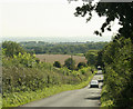
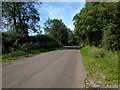
2009 : King's Road
Heading south to Chelynch and Doulting.
Lodge Farm is about 200 yards down the hill on the right and Windmill Farm opposite.
Image: © Maurice Pullin
Taken: 11 Sep 2009
0.10 miles
2
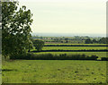
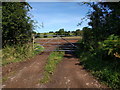
2009 : South from Bolter's Lane
Mostly pasture with a hint or two of arable where fields have been prepared for next year's crop.
The next place of any size in this direction is Evercreech about four miles over.
Image: © Maurice Pullin
Taken: 11 Sep 2009
0.10 miles
3
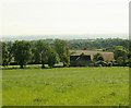
2009 : Windmill Farm
Turning to the right from Image we find a better view of the farm, much of which seems to be pasture though there are signs of arable further over.
Image: © Maurice Pullin
Taken: 11 Sep 2009
0.11 miles
4
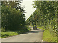
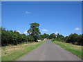
2009 : Bolter's Lane
Heading west toward Shepton Mallet.
Image: © Maurice Pullin
Taken: 11 Sep 2009
0.15 miles
7
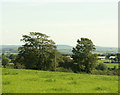
2009 : Pasture land near Windmill Farm
The farm appears to the right.
The small blob on the horizon centre screen is Alfred's Tower Image distance 9 miles.
Image: © Maurice Pullin
Taken: 11 Sep 2009
0.18 miles
8
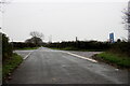
Crossroads on Waggon and Horses Hill
This is the crossroads where King's Road running up Waggon and Horses Hill crosses Bolters Lane.
Image: © Nigel Mykura
Taken: 5 Nov 2022
0.19 miles
9
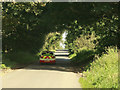
Bolter's Lane
A view looking to the northeast along Bolter's Lane. A travellers encampment can be seen on the verge on the left.
Image: © Phil Williams
Taken: 18 Jul 2007
0.21 miles
10
2009 : Highway Maintenance vehicle on Bolter's Lane
Looking east toward Frome.
Image: © Maurice Pullin
Taken: 11 Sep 2009
0.21 miles