
IMAGES TAKEN NEAR TO
Hemington, RADSTOCK, BA3 5XS
Introduction
This page details the photographs taken nearby to BA3 5XS by members of the Geograph project.
The Geograph project started in 2005 with the aim of publishing, organising and preserving representative images for every square kilometre of Great Britain, Ireland and the Isle of Man.

There are currently over 7.5m images from over14,400 individuals and you can help contribute to the project by visiting https://www.geograph.org.uk
Image Map
Images are licensed for reuse under creativecommons.org/licenses/by-sa/2.0
Notes
- Clicking on the map will re-center to the selected point.
- The higher the marker number, the further away the image location is from the centre of the postcode.
Image Listing (10 Images Found)
Images are licensed for reuse under creativecommons.org/licenses/by-sa/2.0
Image
Details
Distance
1
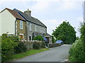
2008 : Cottage at the junction of Hammer Lane and Row Lane
Clematis montana rubens on the wall.
Image: © Maurice Pullin
Taken: 24 May 2008
0.00 miles
2
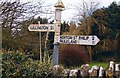
Old Direction Sign - Signpost by Hammer Lane, Hemington Parish
Pyramid finial - 2 arms; Somerset SCC pyramid by the UC road, in parish of Hemington (Mendip District), Charlton Farm, Hammer Lane junction with Row Lane, West side of road.
Surveyed
Milestone Society National ID: SO_ST7654.
Image: © Milestone Society
Taken: Unknown
0.01 miles
3
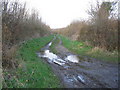
Bridleway to Norton St. Philip
A view looking to the northeast along Marrow Pole Lane, a public bridleway leading to Norton St. Philip.
Image: © Phil Williams
Taken: 31 Jan 2007
0.08 miles
4
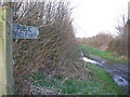
Marrow Pole Lane
A view looking to the northeast along the public bridleway of Marrow Pole Lane.
Image: © Phil Williams
Taken: 31 Jan 2007
0.09 miles
5
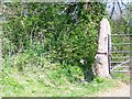
Gate post, Charlton Farm
Horses are required to leave the bridleway through the gap beside the former tree trunk gate post and the hedge.
Image: © Maigheach-gheal
Taken: 19 Apr 2009
0.10 miles
6
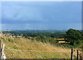
2008 : South east from Charlton Farm
Battlesbury Hill Image on the edge of Salisbury Plain is on the horizon with a thunderstorm behind it.
Image: © Maurice Pullin
Taken: 12 Aug 2008
0.15 miles
7
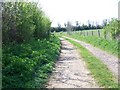
Bridleway from Hammer Lane
The bridleway leaves Hammer Lane at Charlton Farm and heads to Chickwell Farm on Chickwell Lane. It is a broad track all the way.
Image: © Maigheach-gheal
Taken: 19 Apr 2009
0.16 miles
8
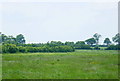
2008 : Field off Marrow Pole Lane
Looking west from the track between Charlton Farm and Norton St. Philip.
The grass does not look right for hay though it could be used for silage, the farmer may put his cattle straight on to it for some good grazing. Come what may it all ends up in the same place.
Image: © Maurice Pullin
Taken: 24 May 2008
0.17 miles
9
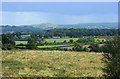
2008 : South east from Charlton Farm (2)
Image: © Maurice Pullin
Taken: 12 Aug 2008
0.18 miles
10
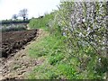
Headland off Hammer Lane
The field has recently been ploughed leaving a good headland.
Image: © Maigheach-gheal
Taken: 19 Apr 2009
0.22 miles