
IMAGES TAKEN NEAR TO
Faulkland, RADSTOCK, BA3 5XF
Introduction
This page details the photographs taken nearby to BA3 5XF by members of the Geograph project.
The Geograph project started in 2005 with the aim of publishing, organising and preserving representative images for every square kilometre of Great Britain, Ireland and the Isle of Man.

There are currently over 7.5m images from over14,400 individuals and you can help contribute to the project by visiting https://www.geograph.org.uk
Image Map
Images are licensed for reuse under creativecommons.org/licenses/by-sa/2.0
Notes
- Clicking on the map will re-center to the selected point.
- The higher the marker number, the further away the image location is from the centre of the postcode.
Image Listing (15 Images Found)
Images are licensed for reuse under creativecommons.org/licenses/by-sa/2.0
Image
Details
Distance
1
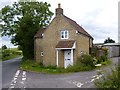
Old Toll House by the A366, Faulkland
Toll House by the A366, in parish of Hemington, The Toll House, Tucker's Grave Crossroads, Faulkland, BA3 5XF.
Somerset HER.
HER number: 40922 https://www.heritagegateway.org.uk/Gateway/Results_Single.aspx?uid=40922&resourceID=100
Surveyed
Milestone Society National ID: SO.HEM
Image: © Alan Rosevear
Taken: 24 Jun 2013
0.00 miles
2
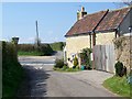
Road junction, Tuckers Grave
The minor road meets the A366 at this junction. The building to the right is the premises of a building contractor.
Image: © Maigheach-gheal
Taken: 19 Apr 2009
0.01 miles
3
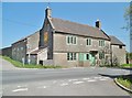
Faulkland, Tucker's Grave Inn
Historic public house on Wells Road, named after a 1747 suicide, Edwin Tucker; in those days, it was customary to bury suicides at crossroads. A strikingly simple interior, with entrance from the back to a corridor; left, tap room (with an antiquely painted sign), wooden benches, wood-burning stove and wooden shutters; also the home to shove-halfpenny and bar skittles boards. Right, servery - one of very few pubs without a counter. Beer and Cider are dispensed by gravity from containers by the wall. Also in this area, a small snug, and behind the servery Rose Room, originally private. Cask ale on offer: Butcombe Original, with draught ciders. Externally, garden with well, skittle alley and camping site. The pub is listed in the Good Beer Guide, CAMRA's National Inventory of Historic Pub Interiors, and by Historic England: https://historicengland.org.uk/listing/the-list/list-entry/1058676
Image: © Mike Faherty
Taken: 6 May 2018
0.01 miles
4
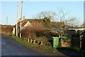
2007 : Bingwell Farm
The roof of Tucker's Grave Inn can be seen on the other side of the A366.
The side road we are on comes from Lullington and continues toward Wellow on the other side of the main road.
Image: © Maurice Pullin
Taken: 3 Dec 2007
0.01 miles
5
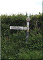
Old Direction Sign - Signpost by the A366, Tucker's Grave Crossroads, Hemington Parish
Pyramid finial - 1 arm; Somerset SCC pyramid by the A366, in parish of Hemington (Mendip District), Tucker's Grave Crossroads, Faulkland, by former Tuckers Grave tollhouse, in hedge.
Surveyed
Milestone Society National ID: SO_ST7555
Image: © Alan Rosevear
Taken: 24 Jun 2013
0.01 miles
6
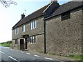
Tuckers Grave Inn
The inn is a traditional cider house. The inn is named after a local man who hanged himself in 1747 in a barn near the present inn. As was custom he was buried in unconsecrated ground, said to be where the car park of the inn is today. I am unsure if it was open or closed!
Image: © Maigheach-gheal
Taken: 19 Apr 2009
0.02 miles
7
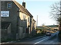
2007 : Tuckers Grave Inn
Locally known as a cider house (with justification).http://www.beerintheevening.com/pubs/s/15/15054/Tuckers_Grave_Inn/Faulkland
The road is the A366 toward Norton St. Philip.
Image: © Maurice Pullin
Taken: 3 Dec 2007
0.03 miles
8
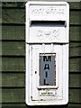
George VI Postbox, Tuckers Grave
The mail box for the building contractors.
Image: © Maigheach-gheal
Taken: 19 Apr 2009
0.03 miles
9
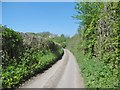
Faulkland, Knoll Lane
Country lane from Wells Road to Knoll Farm and beyond.
Image: © Mike Faherty
Taken: 6 May 2018
0.06 miles
10
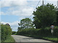
The A366 leaves Tucker's Bottom
Image: © Sarah Charlesworth
Taken: 16 Jun 2011
0.10 miles