
IMAGES TAKEN NEAR TO
Thickthorn Lane, RADSTOCK, BA3 4XS
Introduction
This page details the photographs taken nearby to Thickthorn Lane, BA3 4XS by members of the Geograph project.
The Geograph project started in 2005 with the aim of publishing, organising and preserving representative images for every square kilometre of Great Britain, Ireland and the Isle of Man.

There are currently over 7.5m images from over14,400 individuals and you can help contribute to the project by visiting https://www.geograph.org.uk
Image Map
Images are licensed for reuse under creativecommons.org/licenses/by-sa/2.0
Notes
- Clicking on the map will re-center to the selected point.
- The higher the marker number, the further away the image location is from the centre of the postcode.
Image Listing (12 Images Found)
Images are licensed for reuse under creativecommons.org/licenses/by-sa/2.0
Image
Details
Distance
1
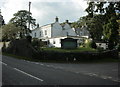
2009 : The Court, Chilcompton
Or is it Old Down?
Either way it was impossible to resist sharing this:
"The origin of The Court is far from clear and is clouded with rumour.
It is strategically placed at the edge of the Mendip Hills with commanding views to the North. Previously known as The Thousand Pound House, Perry's Coffee Rooms and Lynch Hill House, the current name is generally accepted to be associated with possible Court Trials (Judge Jeffrey's etc). A picture of the Judge Jeffrey that was previously hung in the famous Wig & Pen Club, Fleet Street, London now greets guests as they enter the hotel lounge area."
Copied from: http://www.courthotel.co.uk/history.htm
Image: © Maurice Pullin
Taken: 10 Oct 2009
0.01 miles
2

Field by B3139
Looking left from Image], with a little overlap. The scaffolded house is across the B road. The two trees in the field on the right can also be seen in Image
Image: © Derek Harper
Taken: 1 Apr 2025
0.07 miles
3

2009 : B3139 almost at Chilcompton
Near the end of Thickthorn Lane about to venture down Lynch Hill into Chilcompton. After that the A367 is reached at White Post then Kilmersdon.
Old Down is a short way behind.
Image: © Maurice Pullin
Taken: 10 Oct 2009
0.08 miles
4
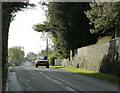
2009 : B3139 nearly at Old Down
Taken at the end of Thickthorn Lane. Chilcompton has been left behind, Old Down approaches and the A37 is soon to be crossed.
Image: © Maurice Pullin
Taken: 10 Oct 2009
0.10 miles
5

Sheep by Coalpit Lane
Taken on the other side of the lane from Image The lane is briefly along a easting grid line and a parish boundary. The twin trees inn the field also appear in Image The fence bounding the field runs along the side of the dismantled Somerset and Dorset Joint Railway line.
Image: © Derek Harper
Taken: 1 Apr 2025
0.11 miles
6

Field by Coalpit Lane
Part of the sheep pasture shown in Image], taken 80 metres southwards along the lane shown in Image The fence runs along the side of the dismantled Somerset and Dorset Joint Railway line.
Image: © Derek Harper
Taken: 1 Apr 2025
0.12 miles
7

Coalpit Lane
For the last 150 metres before reaching the B3139, the lane follows an easting gridline and also carries the parish boundary between Chilcompton (right) and Binegar.
Image: © Derek Harper
Taken: 1 Apr 2025
0.13 miles
8
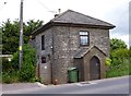
Old Toll House, Old Down
Toll House by the B3139, The Old Turnpike, Old Down, Lynch Hill at its junction with Coalpit Lane, Chilcompton.
Somerset HER.
HER number: 36823. https://www.heritagegateway.org.uk/Gateway/Results_Single.aspx?uid=36823&resourceID=100
Surveyed
Milestone Society National ID: SO.CHC
Image: © Alan Rosevear
Taken: 24 Jun 2013
0.13 miles
9

Field by B3139
Footpath SM 3/1 sets out across Old Down from Coalppit Lane. The hedge is alongside the B road.
Image: © Derek Harper
Taken: 1 Apr 2025
0.19 miles
10
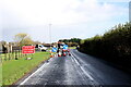
Temporary Traffic lights on Lynch Hill
These temporary lights are just outside The Rookery, the headquarters factory of the Mulberry Luxury leather goods company, whose entrance can just be seen on the left.
Image: © Nigel Mykura
Taken: 2 Nov 2020
0.23 miles