Old Toll House, Old Down
Introduction
The photograph on this page of Old Toll House, Old Down by Alan Rosevear as part of the Geograph project.
The Geograph project started in 2005 with the aim of publishing, organising and preserving representative images for every square kilometre of Great Britain, Ireland and the Isle of Man.

There are currently over 7.5m images from over 14,400 individuals and you can help contribute to the project by visiting https://www.geograph.org.uk
Old Toll House, Old Down
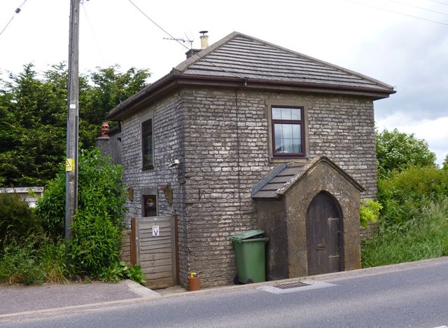
Image: © Alan Rosevear Taken: 24 Jun 2013
Toll House by the B3139, The Old Turnpike, Old Down, Lynch Hill at its junction with Coalpit Lane, Chilcompton. Somerset HER. HER number: 36823. https://www.heritagegateway.org.uk/Gateway/Results_Single.aspx?uid=36823&resourceID=100 Surveyed Milestone Society National ID: SO.CHC
Images are licensed for reuse under creativecommons.org/licenses/by-sa/2.0
Image Location


Leaflet Map data © OpenStreetMap
Latitude
51.259372
Longitude
-2.531912