
IMAGES TAKEN NEAR TO
Wells Road, RADSTOCK, BA3 3GB
Introduction
This page details the photographs taken nearby to Wells Road, BA3 3GB by members of the Geograph project.
The Geograph project started in 2005 with the aim of publishing, organising and preserving representative images for every square kilometre of Great Britain, Ireland and the Isle of Man.

There are currently over 7.5m images from over14,400 individuals and you can help contribute to the project by visiting https://www.geograph.org.uk
Image Map
Images are licensed for reuse under creativecommons.org/licenses/by-sa/2.0
Notes
- Clicking on the map will re-center to the selected point.
- The higher the marker number, the further away the image location is from the centre of the postcode.
Image Listing (88 Images Found)
Images are licensed for reuse under creativecommons.org/licenses/by-sa/2.0
Image
Details
Distance
1
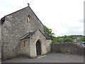
St Hugh's Catholic Church
The church is in the care of a priest from Downside Abbey and holds services on Sundays and holy days. There is an adjacent car park. Until very recently Bath & NE Somerset Council paid for Catholic secondary school children in Radstock to be bussed to St Gregory's School in Bath. The church building was originally a barn and then was part of Parnell's Printing Works before being made into a church. [2018 update: St Hugh's has now closed and been sold]
Image: © HelenK
Taken: 2 Jun 2016
0.01 miles
2

Abandoned car park, Radstock
Served the now closed Co-op supermarket.
Image: © Jonathan Thacker
Taken: 23 Sep 2021
0.03 miles
3
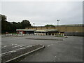
Abandoned Co-op supermarket, Radstock
The largest building in the centre of Radstock, now abandoned and replaced by a smaller store nearby.
Image: © Jonathan Thacker
Taken: 23 Sep 2021
0.05 miles
4
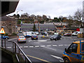
Radstock roundabouts
View Northish across the Radzone roundabouts to the miners wheel and the old market building taken from the entrance to Radco
Image: © Thomas Pinkney
Taken: 14 Dec 2006
0.05 miles
5
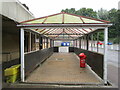
No more trolleys
The large Co-op supermarket in Radstock has closed and been replaced by a smaller store elsewhere in the town.
Image: © Jonathan Thacker
Taken: 23 Sep 2021
0.05 miles
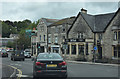
7
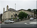
The beginning of Wells Road, Radstock
Image: © Jonathan Thacker
Taken: 23 Sep 2021
0.06 miles
8
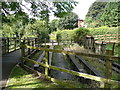
Bridge structure over Wellow Brook
A bridge formerly used by the Great Western Railway's line between Frome and Bristol. This line ran parallel to and slightly below the adjacent Somerset and Dorset Railway line.
Image: © Humphrey Bolton
Taken: 20 Sep 2013
0.07 miles
9
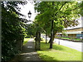
Path alongside the A362, Radstock
A pleasant walkway where there was once a coal mine. The building over the road is a Co-op supermarket.
Image: © Humphrey Bolton
Taken: 20 Sep 2013
0.07 miles
10
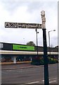
Direction Sign - Signpost by the A367 in Radstock
Lost finial - 1 arm; Somerset SCC pyramid by the A367, in parish of Norton Radstock (Bath and North East Somerset District), Wells Road, junction with The Street. The signpost was on a grass triangle with a tree, all of which have been swept away leaving a wide open junction, sometime after 2012.
Surveyed
Milestone Society National ID: SO_ST6854
Image: © Milestone Society
Taken: Unknown
0.07 miles