
IMAGES TAKEN NEAR TO
Fern Close, RADSTOCK, BA3 2EA
Introduction
This page details the photographs taken nearby to Fern Close, BA3 2EA by members of the Geograph project.
The Geograph project started in 2005 with the aim of publishing, organising and preserving representative images for every square kilometre of Great Britain, Ireland and the Isle of Man.

There are currently over 7.5m images from over14,400 individuals and you can help contribute to the project by visiting https://www.geograph.org.uk
Image Map
Images are licensed for reuse under creativecommons.org/licenses/by-sa/2.0
Notes
- Clicking on the map will re-center to the selected point.
- The higher the marker number, the further away the image location is from the centre of the postcode.
Image Listing (66 Images Found)
Images are licensed for reuse under creativecommons.org/licenses/by-sa/2.0
Image
Details
Distance
1
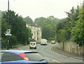
2009 : B3355 Silver Street, Midsomer Norton
Heading south from the shopping centre. An interesting Railway Centre is less than half a mile up the hill.
Image: © Maurice Pullin
Taken: 10 Aug 2009
0.03 miles
2
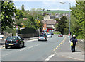
2010 : Silver Street, Midsomer Norton
A lady struggles up the long steep hill from the shops in Midsomer Norton.
The fields on the far side of the valley make Midsomer Norton appear smaller than it is, stretching east to west along the valley it joins seamlessly with Radstock to the east and is almost in contact with Paulton to the north.
Image: © Maurice Pullin
Taken: 10 May 2010
0.04 miles
3
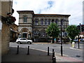
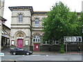
Midsomer Norton: the town hall
This frontage of the Town Hall stands at the end of Silver Street (left), with High Street both to the right and behind us.
Image: © Chris Downer
Taken: 3 Jul 2010
0.08 miles
4
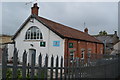
ACF Drill Hall - High Street
Behind the Riverside Bar which provided the drill sergeant's accommodation,orderly room, armoury and a recreation room on first floor.
The town's new Territorial drill hall was opened by Earl Waldegrave supported by Lord Strachie on June 13, 1914.
It shares features with the other Territorial Force halls built in the immediate pre-WW1 period in Somerset.
Image: © John M
Taken: 20 Sep 2014
0.09 miles
5
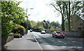
2010 : B3355 leaving Midsomer Norton
Thanks to well planted gardens Silver Street has a surprisingly rural appearance.
Image: © Maurice Pullin
Taken: 10 May 2010
0.09 miles
6
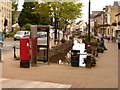
Midsomer Norton: postbox № BA3 264, High Street
This postbox stands at the point where the River Somer emerges from under the road to flow alongside the High Street. The post office is a few yards along, on the right.
Image: © Chris Downer
Taken: 3 Jul 2010
0.10 miles
8
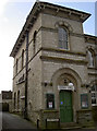
The town hall
Available for plenty of room hire options. See Image] for another view.
Image: © Neil Owen
Taken: 14 Feb 2013
0.10 miles
9
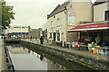
2009 : High Street and River Somer, Midsomer Norton
"Long term management and cleaning of the river Somer was voted as number one priority in July 2007 by our members."
The above was copied from: http://www.midsomernortonsociety.co.uk/Projects%20River.htm
A worthwhile project, the results of their efforts are obvious.
Image: © Maurice Pullin
Taken: 10 Aug 2009
0.10 miles
10
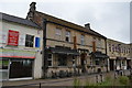
Riverside Bar - High Street
Formerly used as drill hall prior to WW1 with hall to rear.
Image: © John M
Taken: 20 Sep 2014
0.11 miles