
IMAGES TAKEN NEAR TO
Nailwell, BATH, BA2 9EA
Introduction
This page details the photographs taken nearby to BA2 9EA by members of the Geograph project.
The Geograph project started in 2005 with the aim of publishing, organising and preserving representative images for every square kilometre of Great Britain, Ireland and the Isle of Man.

There are currently over 7.5m images from over14,400 individuals and you can help contribute to the project by visiting https://www.geograph.org.uk
Image Map
Images are licensed for reuse under creativecommons.org/licenses/by-sa/2.0
Notes
- Clicking on the map will re-center to the selected point.
- The higher the marker number, the further away the image location is from the centre of the postcode.
Image Listing (12 Images Found)
Images are licensed for reuse under creativecommons.org/licenses/by-sa/2.0
Image
Details
Distance
1
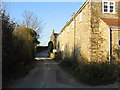
Nailwell
A view looking to the northeast along Englishcombe Lane from the small bridge over stream in the hamlet of Nailwell.
Image: © Phil Williams
Taken: 13 Mar 2007
0.01 miles
2
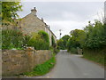
Houses in Nailwell
Nailwell is a small hamlet on the Priston Road halfway up Duncorn Hill. These cottages are right on the narrow road that runs through it.
Image: © Nigel Mykura
Taken: 30 Sep 2012
0.02 miles
3
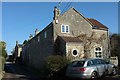
Cottages, Nailwell
A hamlet on Priston Road; four of the houses are shown here and there are just four more.
Image: © Derek Harper
Taken: 16 Feb 2016
0.03 miles
5
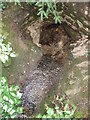
Swallowing water in Nailwell
Right under the Priston Road is a water source that drops into this stone culvert.
Image: © Neil Owen
Taken: 6 Mar 2021
0.05 miles
6
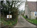
View along part of the bridleway to Longhouse
Image: © Nick Smith
Taken: 20 Feb 2008
0.05 miles
7
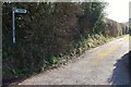
Right of way, Nailwell
The generic term is intentional. This is signposted as a bridleway, but is mapped, for the first 137 metres at least, as a byway open to all traffic, number BA 11/23. It then crosses a parish boundary (from Englishcombe into Dunkerton) and becomes a bridleway, number BA 10/28/. View from the same junction as Image
Image: © Derek Harper
Taken: 16 Feb 2016
0.06 miles
8
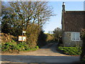
Bridleway to Longhouse
A view looking south-southeast across Englishcombe Lane towards the start of the public bridleway from Nailwell to Longhouse.
Image: © Phil Williams
Taken: 13 Mar 2007
0.06 miles
9
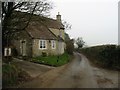
Looking SW along road through Nailwell
The bridleway to Longhouse passes to the left of Nailwell House.
Image: © Nick Smith
Taken: 20 Feb 2008
0.06 miles
10
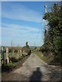
Stitchings Lane
Leading away from its junction with Priston Road towards Inglesbatch. That's not my shadow, but the shadow of the chimney stack on Nailwell House.
Image: © Derek Harper
Taken: 16 Feb 2016
0.08 miles