
IMAGES TAKEN NEAR TO
Bath Road, BATH, BA2 9DQ
Introduction
This page details the photographs taken nearby to Bath Road, BA2 9DQ by members of the Geograph project.
The Geograph project started in 2005 with the aim of publishing, organising and preserving representative images for every square kilometre of Great Britain, Ireland and the Isle of Man.

There are currently over 7.5m images from over14,400 individuals and you can help contribute to the project by visiting https://www.geograph.org.uk
Image Map
Images are licensed for reuse under creativecommons.org/licenses/by-sa/2.0
Notes
- Clicking on the map will re-center to the selected point.
- The higher the marker number, the further away the image location is from the centre of the postcode.
Image Listing (12 Images Found)
Images are licensed for reuse under creativecommons.org/licenses/by-sa/2.0
Image
Details
Distance
1
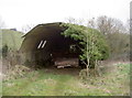
Wood barn
An unusually-shaped barn, with asbestos roofing, is open and contains a few large tree trunks.
Image: © Neil Owen
Taken: 15 Mar 2016
0.10 miles
2
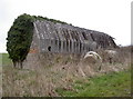
Asbestos barn
An unusual example of a farm building, with an asbestos roof, semi-dodecagonal in profile and with a brick/concrete base wall. See Image] for what's in it.
Image: © Neil Owen
Taken: 15 Mar 2016
0.10 miles
3
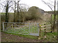
Meeting up at the barn
Two footpaths merge here and head towards the odd-looking barn.
Image: © Neil Owen
Taken: 15 Mar 2016
0.11 miles
4
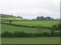
Farmland adjoining the A39
Marksbury, including its church, is visible on the right. On the left can be seen road signs marking the end of a fleeting stretch of dual carriageway, possibly intended to enable the overtaking of tractors or other farm vehicles.
Image: © HelenK
Taken: 9 May 2007
0.18 miles
5
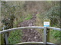
Improved version
The sign says this footpath has been improved by Bath and North East Somerset Council.
Image: © Neil Owen
Taken: 15 Mar 2016
0.21 miles
6
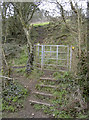
Over the flank of Winsbury Hill
This path leaves the road to Court Farm and heads towards the locally prominent Winsbury Hill, of which this land forms a small prominence.
Image: © Neil Owen
Taken: 15 Mar 2016
0.22 miles
7
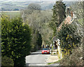
2009 : Lane to Marksbury Vale
Via Court Farm.
Most of the village is at the top of the hill, along the old main road, though a little spills over.
Somerset scenery south of Keynsham in the background.
Image: © Maurice Pullin
Taken: 15 Mar 2009
0.22 miles
8
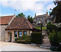
The Chapel, Marksbury
Now used as a smart holiday let. How times change....
See also Image
Image: © Rick Crowley
Taken: 17 Jul 2020
0.23 miles
9
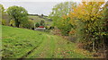
Autumn tree colours beside the footpath to Court Farm
Image: © Dr Duncan Pepper
Taken: 28 Oct 2016
0.23 miles
10
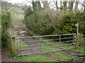
Definite a welly walk
This footpath to Roundhill and Common Woods goes right over the Bathford Brook, which rises in the village. It is normally underfoot but the rains have brought it up a bit more.
Image: © Neil Owen
Taken: 15 Mar 2016
0.24 miles