
IMAGES TAKEN NEAR TO
Combe Hay, BATH, BA2 8RE
Introduction
This page details the photographs taken nearby to BA2 8RE by members of the Geograph project.
The Geograph project started in 2005 with the aim of publishing, organising and preserving representative images for every square kilometre of Great Britain, Ireland and the Isle of Man.

There are currently over 7.5m images from over14,400 individuals and you can help contribute to the project by visiting https://www.geograph.org.uk
Image Map
Images are licensed for reuse under creativecommons.org/licenses/by-sa/2.0
Notes
- Clicking on the map will re-center to the selected point.
- The higher the marker number, the further away the image location is from the centre of the postcode.
Image Listing (10 Images Found)
Images are licensed for reuse under creativecommons.org/licenses/by-sa/2.0
Image
Details
Distance
1
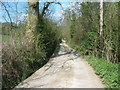
The lane to Fortnight Farm above Combe Hay
This lane is a Byway Open To All Traffic.
Image: © James Ayres
Taken: 18 Apr 2010
0.02 miles
2
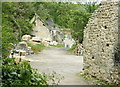
2008 : Week Farm near Combe Hay
OS Explorer 155 makes no mention of a stone mine or quarry near here, these blocks were probably brought in for storage, perhaps for use on site.
Image: © Maurice Pullin
Taken: 10 May 2008
0.07 miles
4
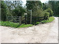
Public Footpath/Byway junction
The path follows the stream
Image: © James Ayres
Taken: 18 Apr 2010
0.12 miles
5
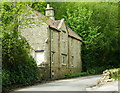
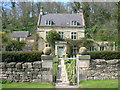
2008 : Week cottage near Combe Hay
Opposite Week Farm on the old Combe Hay to Widcombe turnpike.
Image: © Maurice Pullin
Taken: 10 May 2008
0.15 miles
6
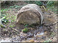
Soggy bale
A bale has fallen into the stream, presumably in error or malice. Slowly it seems to be dissolving.
Image: © Neil Owen
Taken: 8 Mar 2021
0.19 miles
7
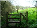
Stile on the path down towards the old railway line
Image: © James Ayres
Taken: 18 Apr 2010
0.20 miles
8
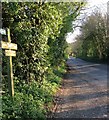
Periods of time
Local farms here are named after periods of time. Down the road ahead is Week Farm, Fortnight Farm lies behind and the sign also points to 'Three Days'.
Image: © HelenK
Taken: 6 Apr 2017
0.21 miles
9
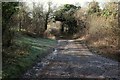
Byway to Fortnight Farm
BOAT (byway open to all traffic) BA 7/4 passes a gateway on the left as it descends the combe shown in Image] and Image See also Image Footpath BA 7/3 leaves to the right here, as shown in Image
Image: © Derek Harper
Taken: 16 Feb 2016
0.23 miles
10
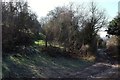
Gateway and byway near Fortnight Farm
Another view of the place shown in Image] where BOAT (byway open to all traffic) BA 7/4 passes a gateway into a steep hillside field.
Image: © Derek Harper
Taken: 16 Feb 2016
0.23 miles