
IMAGES TAKEN NEAR TO
Upper Midford, BATH, BA2 7EJ
Introduction
This page details the photographs taken nearby to BA2 7EJ by members of the Geograph project.
The Geograph project started in 2005 with the aim of publishing, organising and preserving representative images for every square kilometre of Great Britain, Ireland and the Isle of Man.

There are currently over 7.5m images from over14,400 individuals and you can help contribute to the project by visiting https://www.geograph.org.uk
Image Map
Images are licensed for reuse under creativecommons.org/licenses/by-sa/2.0
Notes
- Clicking on the map will re-center to the selected point.
- The higher the marker number, the further away the image location is from the centre of the postcode.
Image Listing (23 Images Found)
Images are licensed for reuse under creativecommons.org/licenses/by-sa/2.0
Image
Details
Distance
2
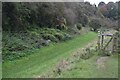
Path beside former Somerset Coal Canal
We are here approaching the junction with the never-completed Radstock branch, just west of Midford.
Image: © David Martin
Taken: 24 Oct 2024
0.08 miles
3
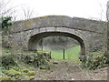
Bridge across the Somerset Coal Canal
Bridge across the course of the former Somerset Coal Canal.
Note the towpath on the left beneath the bridge, with marks in the stonework where ropes towing the narrow boats have worn grooves.
Image: © David Tyers
Taken: 7 Apr 2013
0.09 miles
4
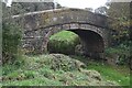
Bridge over former Somerset Coal Canal
Image: © David Martin
Taken: 24 Oct 2024
0.09 miles
5
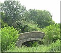
Derelict canal bridge
This bridge crossed the Somerset Coal Canal close by the Midford Aqueduct
Image: © Peter Goodwin
Taken: 27 Jul 2007
0.10 miles
6
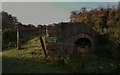
Read the Sign?
Somerset Coal Canal bridge no longer in use over a canal that no longer exists? Near the Cam Brook, at Midford, Bath
Image: © D M Wilmot
Taken: 24 Oct 2013
0.10 miles
7
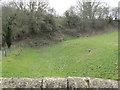
Channel of Somerset Coal Canal
Looking south from a bridge over the former Somerset Coal Canal along the channel of the Canal. Note the boundary stone on the right bank.
Note also the embankment of the former Camerton and Limpley Stoke Railway crossing the course of the canal. The canal had been closed in 1898 and was legally abandoned in 1904. The railway did not open until 1910, so there was no need for a bridge to be built across the canal here.
Image: © David Tyers
Taken: 7 Apr 2013
0.10 miles
8
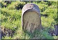
Old Boundary Marker beside the Somerset Coal Canal in Southstoke parish
Canal Boundary Marker on the west side of the abandoned and dry course of the Somerset Coal Canal, between a canal bridge and the embankment of a disused railway. Southstoke parish. Canal information https://en.wikipedia.org/wiki/Somerset_Coal_Canal. See also https://www.geograph.org.uk/photo/3912724.
Milestone Society National ID: SO_SCCSST01em
Image: © P Jenkins
Taken: 23 Mar 2022
0.11 miles
9
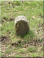
Boundary Stone
Boundary stone on the bank of the Somerset Coal Canal. "CCC" stands for "Coal Canal Company"
Image: © David Tyers
Taken: 7 Apr 2013
0.11 miles
10
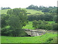
Midford Aqueduct
Once part of the Somerset Coal Canal, by the junction of the canal from Paulton and the tramway from Radstock. The Aqueduct crosses the Cam Brook. Much more about its restoration and the canal's history at http://rtjhomepages.users.btopenworld.com/history.html
Image: © Peter Goodwin
Taken: 27 Jul 2007
0.11 miles