
IMAGES TAKEN NEAR TO
Warminster Road, BATH, BA2 6XQ
Introduction
This page details the photographs taken nearby to Warminster Road, BA2 6XQ by members of the Geograph project.
The Geograph project started in 2005 with the aim of publishing, organising and preserving representative images for every square kilometre of Great Britain, Ireland and the Isle of Man.

There are currently over 7.5m images from over14,400 individuals and you can help contribute to the project by visiting https://www.geograph.org.uk
Image Map
Images are licensed for reuse under creativecommons.org/licenses/by-sa/2.0
Notes
- Clicking on the map will re-center to the selected point.
- The higher the marker number, the further away the image location is from the centre of the postcode.
Image Listing (59 Images Found)
Images are licensed for reuse under creativecommons.org/licenses/by-sa/2.0
Image
Details
Distance
1
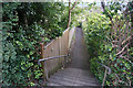
Path behind the houses in Bathampton
A cut down from Warminster Road to the newer housing on Holcombe Close.
Image: © Bill Boaden
Taken: 26 Jul 2016
0.03 miles
2
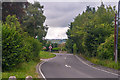
Bathampton : Warminster Road A36
Looking along Warminster Road.
Image: © Lewis Clarke
Taken: 6 Aug 2020
0.05 miles
3
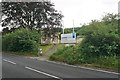
Housing plot in Bathampton
It is a popular course now to take one older house with a large garden and build several houses on the site. On this plot on Warminster Road, there will be three new detached houses.
Image: © Bill Boaden
Taken: 26 Jul 2016
0.05 miles
4
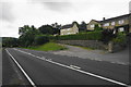
Houses on the edge of Bathampton
These are just about the last houses in Bathampton along Warminster Road. The track in front of them is an easy way to get up onto Bathampton Down.
Image: © Bill Boaden
Taken: 26 Jul 2016
0.07 miles
5
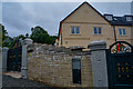
Bathampton : Five Valleys
The gates seem a little extravagant for the house.
Image: © Lewis Clarke
Taken: 6 Aug 2020
0.10 miles
6
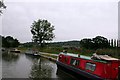
Kennet and Avon canal near Bathampton
The Kennet and Avon canal was restored by the Kennet and Avon canal trust among others, see http://www.katrust.org/ for more info.
Since around 1971, restoration work on the canal has been done by or under the direction of British Waterways.
This section is to the North/North East of Bathampton.
Image: © Martyn Pattison
Taken: 4 Aug 2005
0.10 miles
7
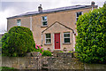
Bathampton : Dry Arch
Looking towards a house off Warminster Road.
Image: © Lewis Clarke
Taken: 6 Aug 2020
0.10 miles
8
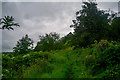
Bathampton : Grassy Path
A grassy path heads up the hill from the canal.
Image: © Lewis Clarke
Taken: 6 Aug 2020
0.13 miles
9
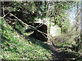
Archway under Bathampton inclined plane
The inclined plane was used to transport stone from the quarries near Claverton & Bathampton to the Kennet & Avon canal.
Image: © Dave Kelly
Taken: 25 Mar 2016
0.13 miles
10
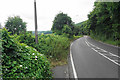
Warminster Road leaving Bathampton
This stretch of the A36 is not very good at all to walk along, but at least there is a footpath to the left leading down to the Kennet & Avon towpath.
Image: © Bill Boaden
Taken: 26 Jul 2016
0.13 miles