
IMAGES TAKEN NEAR TO
Bathwick Rise, BATH, BA2 6RE
Introduction
This page details the photographs taken nearby to Bathwick Rise, BA2 6RE by members of the Geograph project.
The Geograph project started in 2005 with the aim of publishing, organising and preserving representative images for every square kilometre of Great Britain, Ireland and the Isle of Man.

There are currently over 7.5m images from over14,400 individuals and you can help contribute to the project by visiting https://www.geograph.org.uk
Image Map
Images are licensed for reuse under creativecommons.org/licenses/by-sa/2.0
Notes
- Clicking on the map will re-center to the selected point.
- The higher the marker number, the further away the image location is from the centre of the postcode.
Image Listing (158 Images Found)
Images are licensed for reuse under creativecommons.org/licenses/by-sa/2.0
Image
Details
Distance
1
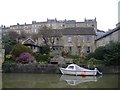
Canal front property, Bath
With private mooring, complete with boat, for a slow getaway.
Image: © Roger Cornfoot
Taken: 17 Feb 2007
0.04 miles
2
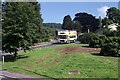
'Minerva' at North Road, Bath ? 1991
Operating the open top bus tour of Bath, as part of a joint arrangement between local bus operator Badgerline, and open-top specialist Guide Friday.
The bus is a Bristol VRT with ECW bodywork, built in 1977 for the Western National Omnibus Company in Devon General colours. It was specifically intended for summer coastal services and had a detachable roof for this purpose. It started work for Badgerline/Guide Friday in 1990 running with successor companies in both open top and enclosed forms until 2005 when it was donated to the Westcountry Historic Omnibus & Transport Trust.
Image: © Alan Murray-Rust
Taken: 6 Jul 1991
0.06 miles
3
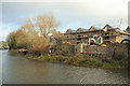
Dwellings under construction, Darlington Wharf
Almost opposite Image
Image: © Derek Harper
Taken: 8 Dec 2019
0.07 miles
4
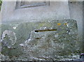
Broken arrows
A benchmark cut into the base of an entrance pillar at the top of Sydney Road. Sadly the ravages of time have taken away the arrows, but the datum line continues to serve. See http://www.bench-marks.org.uk/bm37817 for the Database.
Image: © Neil Owen
Taken: 21 Apr 2011
0.07 miles
5
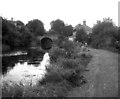
Sydney Gardens No 2 Tunnel, Kennet and Avon Canal
This very short tunnel is seen from the eastern end in 1977. Over the top of the tunnel, the A36 crosses the canal.
Image: © Dr Neil Clifton
Taken: 25 Sep 1977
0.07 miles
6

Bath : Kennet & Avon Canal
Looking along the Kennet & Avon Canal.
Image: © Lewis Clarke
Taken: 6 Aug 2020
0.07 miles
7
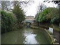
Kennet and Avon canal
Passes through Sydney Gardens at this point.
Image: © Roger Cornfoot
Taken: 17 Feb 2007
0.08 miles
8
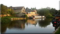
Evening Canal Reflections
Boats and buildings reflecting in the Kennet and Avon Canal as evening falls.
Image: © David Roberts
Taken: 21 Aug 2009
0.08 miles
9

Bath : Kennet & Avon Canal
Looking along the Kennet & Avon Canal.
Image: © Lewis Clarke
Taken: 6 Aug 2020
0.08 miles
10
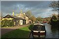
Canal Cottages
The further house is listed rather nicely as "2, Kennet and Avon Canal" https://historicengland.org.uk/listing/the-list/list-entry/1395941 - good to see a canal rather than a street as an address. "This was built as a lengthman's cottage to supervise the pound up to the next length the cottage for which is just beyond Bathampton."
Image: © Derek Harper
Taken: 8 Dec 2019
0.08 miles